
Topic
environment
179 record(s)
Type of resources
Topics
Keywords
Contact for the resource
Provided by
Years
Formats
Representation types
Update frequencies
Status
draft
-
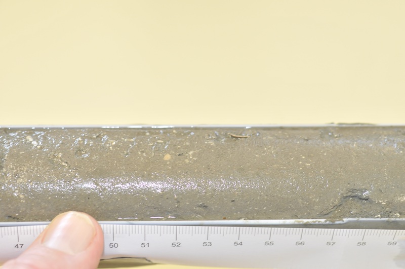
This voyage provides an opportunity to test and refine optimal techniques to map and assess seabed habitat developed in a previous CMR project (NOO OP2000-SE02). Importantly, this voyage will use the National Facility's high-resolution EM300 swath mapper for its first program of biological and physical habitat mapping. The sampling locations are a number of submarine canyons and their immediately adjacent flanks on the west coast of Tasmania and east of Bass Strait. These are prime targets for our methods development because each canyon area is characterised by a great variety of seabed topography and benthic communities concentrated in a relatively small area (< 300 sq km). This voyage is also an opportunity to apply the data collected to marine resource management planning in the South East Region. Submarine canyons represent a type of habitat unit ("Level 3 biogeomorphic units") having a strong influence on the location of offshore Marine Protected Areas on the continental slope and rise, and many are likely to be biodiversity "hotspots". Several canyons are also the locations of the largest known aggregations of feeding and spawning fishes in the South-East Fishery region, and these support a range of intense, increasing and, in places, conflicting fishing activities. Given the immediate and increasing relevance of submarine canyons to conservation and fishery managers, it is then surprising to realize that virtually all those in the SE region remain unsampled by scientists, and are named only by commercial fishers. For these reasons, sampling on this voyage will focus on the "Big Horseshoe Canyon" mapped previously with the EM1002 and EM12 swath instruments (to enable comparison of data types, and to investigate temporal persistence of features), and several "new" areas. Sediment samples were taken for analysis by Geoscience Australia.
-
The remote Kimberley coast of north-western Australia is one of the few marine environments domains on earth largely unaffected by human use. However, the region is undergoing increasing economic importance as a destination for tourism and significant coastal developments associated with oil and gas exploration. The objective of the project was to reconstruct a timeline of inferred water quality changes from the sediment record for a selected set of sites in the Kimberley, Western Australia. The project made use of palaeoecological approaches to reconstruct a chronology of change over the last approximately 100 years using a series of biogeochemical proxies for phytoplankton composition and biomass, temperature and terrestrial influences. Where possible these were matched to historical land/water use, meteorological or hydrological observational records. The project examined sediment cores from three coastal locations, Koolama Bay (King George River), Cygnet Bay and Roebuck Bay. Each sampling location provided a contrast with which to evaluate changes over either a spatial or temporal gradient of human or natural influence. Sediment cores (up to 1.5 m) were obtained from each of these locations in the expectation that they would provide a time series for about the last 100 years. A set of parameters was measured along the core length (every 1-2 cm) for some or all cores depending on the particular focus for the location: 210Pb and 137Cs; 15N isotope; 13C isotope; Carbon/Nitrogen ratio; Sedimentation rate and grain size; Total Organic Carbon (TOC) and Total Nitrogen (TN); Biosilicate; Biomarkers; TEX86; long chain n-alkanes (C27+C29+C31); Elemental carbon (or black carbon). Rainfall data was obtained from the Australian Bureau of Meteorology website (www.bom.gov.au). Stream flow data was obtained from the Western Australian Department of Water website (www.water.wa.gov.au). Historical bushfire data was obtained from the Western Australian Department of Parks and Wildlife. The metadata record only relates to data generated as part of the sediment analysis.
-

Sounding data extracted from: Continental Shelf Research 21 (2001) 157–201 Geochemistry and particle size of surface sediments of Exmouth Gulf, Northwest Shelf, Australia G.J. Brunskill,*, A.R. Orpin, I. Zagorskis, K.J. Woolfe, J. Ellison DOI: 10.1016/S0278-4343(00)00076-5 Project Details: The Pilbara Marine Conservation Partnership (PMCP) was an initiative designed to enhance the net conservation benefits of the globally-significant coral reef ecosystems of the Pilbara (Western Australia) by providing an assessment of the condition and trajectory of key ecological values. These assessments were designed to inform and complement existing governance and management arrangements and the PMCP is intended to provide ongoing advice and assessment for conservation efforts in the region, providing lasting benefits. The PMCP concept is based on three core ecological components, namely: Coral Reef Health - concentrating mainly on habitat forming primary producers. Fish and Sharks - their community structure, interactions and impacts on lower trophic levels. Environmental Pressures - physical and anthropogenic factors that influence the condition of reefs and associated biota.
-
The Flinders Commonwealth Marine Reserve (CMR) survey was a pilot study undertaken in August 2012 as part of the National Marine Biodiversity Hub's National monitoring evaluation and reporting theme. The aim of this theme is to develop a blueprint for the sustained monitoring of the South-east CMR Network. The particular aims of the survey were twofold; 1) to contribute to an inventory of demersal and epibenthic conservation values in the reserve and 2) to test methodologies and deployment strategies in order to inform future survey design efforts. Several gear types were deployed; including multibeam sonar, shallow-water (less than 150m) Baited Remote Underwater Video Systems (BRUVS), deep- water BRUVS (to 600 m), towed video and digital stereo stills. This resource contains the deep-water BRUVS footage captured on the slope (~500m depth) of two sites: the Flinders CMR and the adjacent Cape Barren fisheries closure. At each site 3 stereo deepBRUVS were deployed over a 3-day period, during which they recorded between 11 and 15 1-hour sampling events each.
-
As part of the Pilbara Marine Conservation Partnership (PMCP), coral reef surveys of reef macroalgae species (including seagrasses) were undertaken between northern Ningaloo and the Dampier Archipelago. This dataset contains biomass estimates (g DW m-2 and g WW m-2) of macrophytes collected in shallow reef areas in the Pilbara region during two sampling trips: November 2013 and May 2014. Surveys were undertaken using using SCUBA at depths between 2-13m, with macroalgae and seagrasses identified to the lowest possible taxonomic level. The data include: * Macroalgae and seagrass diversity (0.25 square metre quadrats) * Macroalgae and seagrass species composition and biomass per quadrat (0.25 square metre) These data were collected to estimate macrophyte biomass in shallow reef areas across the Pilbara region in two contrasting seasons. These data are an output of the Pilbara Marine Conservation Partnership (PMCP) Coral Reef Health Theme.
-

Landsat 8 Images were obtained for the project study area (Pilbara Marine Region). Images acquired were Landsat 8 images (Path: 113,114,115 Rows: 74,75,76) for 2013 ranging from Day 110 - 348 (2013-04-20 to 2013-12-14). Data are comprised of 58 files ranging in size from 500 to 1000 MB in compressed format (46 GB total), and are lodged with the iVEC Data Store - https://data.ivec.org The Pilbara Marine Conservation Partnership (PMCP) was an initiative designed to enhance the net conservation benefits of the globally-significant coral reef ecosystems of the Pilbara (Western Australia) by providing an assessment of the condition and trajectory of key ecological values. These assessments were designed to inform and complement existing governance and management arrangements and the PMCP is intended to provide ongoing advice and assessment for conservation efforts in the region, providing lasting benefits. The PMCP concept is based on three core ecological components, namely: Coral Reef Health - concentrating mainly on habitat forming primary producers. Fish and Sharks - their community structure, interactions and impacts on lower trophic levels. Environmental Pressures - physical and anthropogenic factors that influence the condition of reefs and associated biota.
-
Fish and shark assemblage data are being obtained from the analysis of Stereo-BRUV footage captured in May 2014. Data is comprised of raw camera output stream files (.MTS) for 272 Stereo-BRUV drops in shallow water (~10m) between Exmouth and Dampier, Western Australia. Files are less than 1.9GB and total approximately 10TB. Videos are structured within Stereo-BRUV drops (identified with an OpCode i.e. NCB1-NCB272) with a left and right camera folder within each drop. Videos are lodged with the iVEC Data Store - https://data.ivec.org The Pilbara Marine Conservation Partnership (PMCP) was an initiative designed to enhance the net conservation benefits of the globally-significant coral reef ecosystems of the Pilbara (Western Australia) by providing an assessment of the condition and trajectory of key ecological values. These assessments were designed to inform and complement existing governance and management arrangements and the PMCP is intended to provide ongoing advice and assessment for conservation efforts in the region, providing lasting benefits. The PMCP concept is based on three core ecological components, namely: Coral Reef Health - concentrating mainly on habitat forming primary producers. Fish and Sharks - their community structure, interactions and impacts on lower trophic levels. Environmental Pressures - physical and anthropogenic factors that influence the condition of reefs and associated biota.
-
This project is aimed at understanding how coral growth has responded to past changes in regional climate across northern Ningaloo and the Pilbara region by analysing the physical and geochemical composition of cores collected from massive coral (Porites spp.). X-ray images of the sliced coral cores provide us with information on seasonal and inter-annual changes in the density and rate of vertical extension from which we can calculate annual rates of coral growth, or more precisely, 'calcification'. Coral cores from massive Porites spp. were collected from sites across northern Ningaloo (Tantabiddi and Coral Bay in July 2013) and the western Pilbara (Onslow to the Dampier peninsula in April 2014).
-
Plastic pollution is ubiquitous throughout the marine environment, yet estimates of the global abundance and weight of floating plastics have lacked data, particularly from the Southern Hemisphere and remote regions. Here we report an estimate of the total number of plastic particles and their weight floating in the world’s oceans from 24 expeditions (2007–2013) across all five sub-tropical gyres, coastal Australia, Bay of Bengal and the Mediterranean Sea conducting surface net tows (N5680) and visual survey transects of large plastic debris (N5891). Using an oceanographic model of floating debris dispersal calibrated by our data, and correcting for wind-driven vertical mixing, we estimate a minimum of 5.25 trillion particles weighing 268,940 tons. When comparing between four size classes, two microplastic <4.75 mm and meso- and macroplastic >4.75 mm, a tremendous loss of microplastics is observed from the sea surface compared to expected rates of fragmentation, suggesting there are mechanisms at play that remove <4.75 mm plastic particles from the ocean surface.
-
The Flinders Commonwealth Marine Reserve (CMR) survey was a pilot study undertaken in August 2012 as part of the National Marine Biodiversity Hub's National monitoring evaluation and reporting theme. The aim of this theme is to develop a bluepint for the sustained monitoring of the South-east CMR Network. The particular aims of the survey were twofold; 1) to contribute to an inventory of demersal and epibenthic conservation values in the reserve and 2) to test methodologies and deployment strategies in order to inform future survey design efforts. Several gear types were deployed; including multibeam sonar, shallow-water (less than 150m) Baited Remote Underwater Video Systems (BRUVS), deep- water BRUVS (to 600 m), towed video and digital stereo stills. This resource contains the video and stereo still image data collected using a towed system (towed stereo camera system - TSCS). The TSCS was deployed using a probabalistic and spatially balanced survey design called Generalized Random Tessellation Stratified (GRTS). Habitats on the shelf were identified in a previous multibeam survey and consisted of 'mixed reef' (containing patchy reef) and sand. Mixed reef habitat was targeted in this survey (9 GRTS mixed reef sites versus 3 sand sites). Two roughly perpendicular TSCS tows were performed in each of those shelf GRTS sites. On the slope, down-slope (150-500 m depth) transect sites were classified by proportion of hard, soft and mixed bottom types based on multi-beam sonar (MBS) backscatter data. Transects with higher proportion of hard substrates were chosen using a GRTS approach. 7 transects were completed in the Flinders CMR, 5 transects in the adjacent Cape Barren Fisheries closure and two targeted transects were completed in a canyon to the north, where large coral bycatch had been reported from fisheries.