
Topic
inlandWaters
5 record(s)
Type of resources
Topics
Keywords
Contact for the resource
Provided by
Formats
Representation types
Update frequencies
Status
draft
-
Hydrodynamic and wave modelling to simulate currents and wave action over reef and lagoon systems.
-
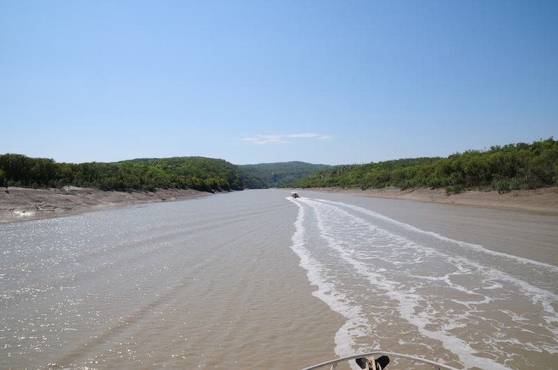
Terrestrial landscapes and coastal marine environments are linked by the rivers that flow between them. This is particularly true in the Kimberley, where each year large amounts of freshwater enter coastal waters. This project aimed to understand how dissolved and particulate material from freshwater systems in the Kimberley are transported by the tides and currents into the coastal marine environment and whether these exports from land play a role in coastal productivity. The project linked closely with WAMSI 2 KMRP projects 2.2.1 and 2.2.2 to better understand how freshwater discharge influences marine food web structure and sustains the productivity of Kimberley inshore ecosystems. Oceanographic and biogeochemical data was collected over two field campaigns (October/November 2013 and April/May 2014) from the Walcott Inlet, Collier Bay area (16° 22.624’S 124° 26.235’E to 16° 24.487’S 124° 54.035’E) and models integrated with those for Collier Bay (KMRP Project 2.2.2). The hydrology component focussed on catchments flowing into Walcott Inlet and Collier Bay, but climate projections and stream flow data analysed for whole of Kimberley. Chemical data to apportion sources of organic matter was also collected. This data was used to support development of the biogeochemical model. No primary data was collected in the hydrology component, but major data sets were collated, including data from 88 streamflow gauging stations managed by the Department of Water. A coupled physical-biogeochemical model and a catchment carbon export model was developed to understand the link between exported material and coastal productivity and has been an important component of the research project as it has allowed estimates of freshwater flow under current and future climate scenarios and an estimate of export of nutrients (carbon and nitrogen) and the forms in which they exist. Historical data used from 1961 to 2012 was used for calibration of the model, and future simulations were run for the period 2013 – 2064. This metadata record only relates to data either collected or generated by CSIRO. For data held by other project partners, please refer to the ‘supplementary information’ section.
-
The Data Interrogation and Visualisation Environment (DIVE) is a graphical tool to interactively explore and visualise a diverse range of datasets. These datatsets range from 1-dimensional point data (e.g. species biomass) to 4-dimensional time-varying volumetric datasets (e.g. model output).
-
In 1991, CSIRO was approached to design and manage an environmental study of the Bay to seek answers to questions concerning the sustainable use and management of the Bay. The Study began in October 1992 and finished in June 1996. The Port Phillip Bay Environmental Study was managed by CSIRO and supervised by a Management Committee chaired by the (then) Department of Conservation and Natural Resources. Also represented on the committee were the EPA, Melbourne Water, Melbourne Parks and Waterways and the former Port of Melbourne Authority. The Study was totally funded by Melbourne Water and Melbourne Parks and Waterways. In all, some 47 research tasks were conducted, ranging from scientific literature reviews to fullscale field surveys. All were contracted out. Of the 30 contractors, six were Victorian State agencies, three Commonwealth agencies, nine universities and 12 consultants. Nineteen contractors were Victorian based, seven from interstate and four from overseas. The research programs covered the fields of physical oceanography, toxicants, algal nutrients, marine ecology and ecological modelling. A final report was delivered "PORT PHILLIP BAY ENVIRONMENTAL STUDY FINAL REPORT" :Harris, G., G. Batley, D. Fox, D. Hall, P. Jernakoff, R. Molloy, A. Murray, B. Newell, J. Parslow, G. Skyring and S. Walker. (1996). Port Phillip Bay Environmental Study Final Report. CSIRO, Canberra, Australia. Published on CD ROM by CSIRO Publishing, Melbourne, 1999.) 47 technical reports were also produced. In additition in April 2007 a data set collection was supplied to CMAR Data Centre by Dr John Parslow (CMAR) on CD ROM, and relates to the Port Phillip Bay Environmental Study conducted between 1992 and 1996. These datasets include: Bathymetric data, Coastline data, Data from current meters and coastal radar, Flow data for rivers, creeks and drains, Various meteorological data sets, Water salinity and temperature data, Data sets from various tide gauges and Sediment related data sets. The CD ROM also includes electronic copies of the Overview Report 39pp, Final report 248pp and the 47 Technical reports. 26, May 2015, Received Port Phillip Bay Environmental StudyData, GIS and Reports CD-ROM created by CSIRO Environmental Projects Office - robert.molloy@csiro.au (2003) from Lawrance Ferns Department of Environment, Land, Water & Planning (lawrance.ferns@delwp.vic.gov.au). Added to PortPhillipBayDATA_additonal netwrok archive and media items.
-
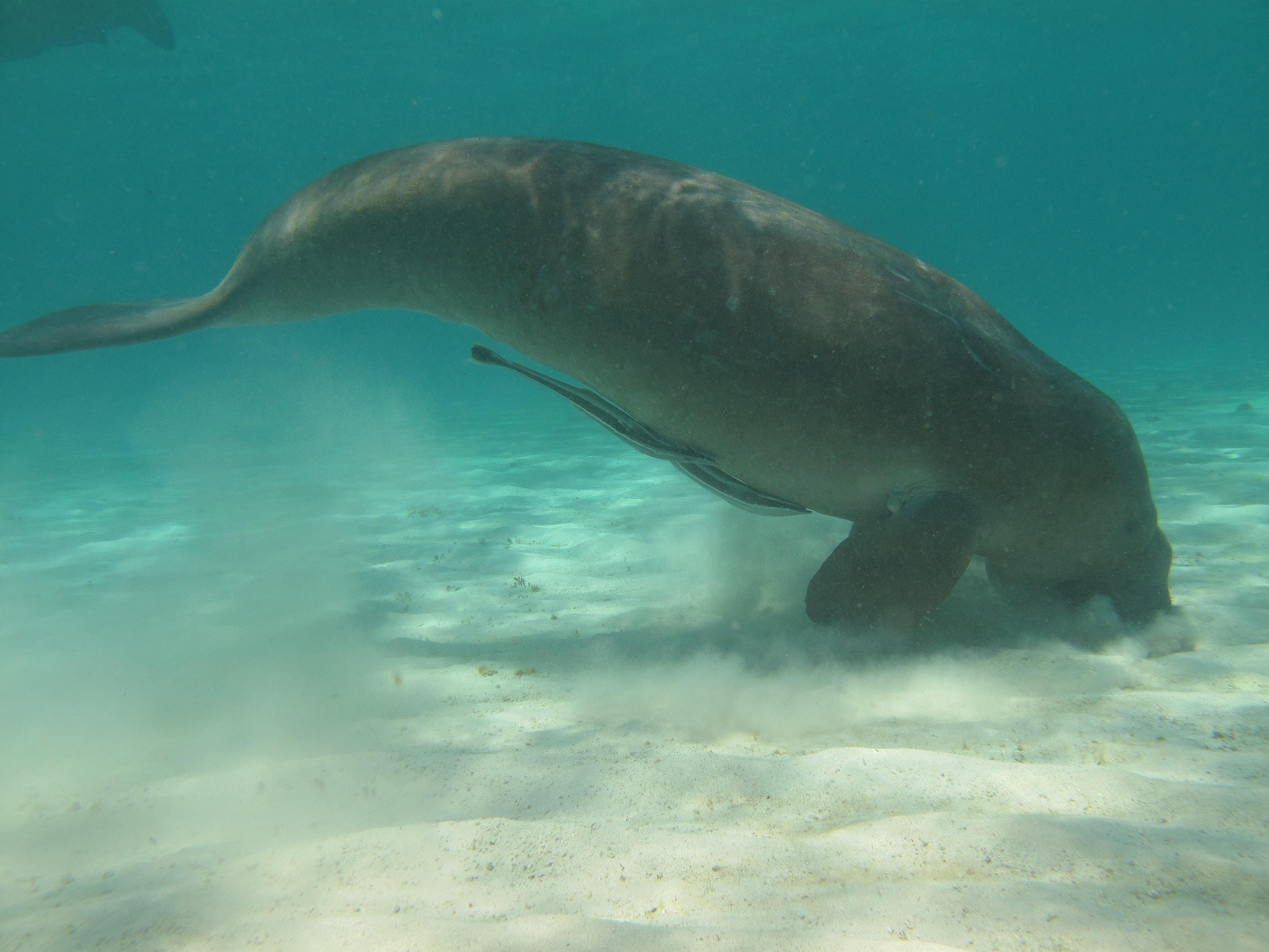
Dugongs (Dugong dugon) are listed as vulnerable on the IUCN Red List of Threatened species and as other specially protected fauna in WA under Schedule 7 of the Wildlife Conservation (Specially Protected Fauna) Notice 2015). Gaps in our knowledge in Western Australia include having a good understanding of the species’ distribution, abundance and high use areas across the northwest. This 3-year project (2014-2017) integrated Indigenous knowledge and scientific observations from field surveys to better understand the distribution, abundance and movements of dugong in the Kimberley region. The data collected also provides a baseline for future monitoring and management. This medata record relates to raw and processed aerial survey data of marine fauna collected between 21st September 2015 and 8th October 2015 in Kimberley coastal waters to the 20m bathymetry line, comprising dugongs (Dugong dugon), Australian snubfin dolphins (Orcaella heinsohni), other dolphins (bottlenose, spinners, false killer whales), humpback whales (Megaptera novaeangliae) and large, mostly green turtles (Chelonia mydas). The WA Department of Biodiversity Conservation and Attractions (DBCA, ex-DPaW) and CSIRO provided additional resources to extend the North Kimberley dugong aerial survey boundary westwards (Broome to just past Port Hedland) to cover the South Kimberley-Pilbara coastal regions, to close the last remaining knowledge gap of the dugong distribution and abundance in Australia. This additional survey was completed in May 2017. Data from a trial movement study undertaken between 1-18th August 2016 also forms part of this metadata record. Five dugongs were tagged with Telonics manatee/dugong tags. GPS and ARGOS satellite detection locations and dive data were downloaded weekly from the ARGOS web site.