
Topic
boundaries
6 record(s)
Type of resources
Topics
Keywords
Contact for the resource
Provided by
Formats
Representation types
Update frequencies
Status
draft
-
The National Oceans Office undertook in September 2001 an analysis of Bioregionalisation for the Australian South-east Marine Region, an integration of geological, oceanographic and biological data as the basis for bioregionalisation. The biological and physical assessment was intended to contribute to the implementation of ecosystem-based management in the South-east Marine Region by developing a shared understanding of the ecosystem. The assessment had two streams, ecosystem structure and ecosystem function and incorporated the input from these projects among others: - Production of a consistent, high quality bathymetric data grid for the south-east marine region. - Seabed characterisation including geomorphology, acoustic facies and seabed sampling (GA) - Computer sediment modelling (GEOMAT) - Refine Broad Scale Bioregionalisation (Provinces and Biomes) (CSIRO) - Upgrade deepwater nutrient, water properties and ocean current models (CSIRO) - Rapid assembly of ecological fish data (CSIRO Marine Research in collaboration with Australian Museum, Victoria Museum and NSW Fisheries) - Rapid assembly of ecological invertebrate data (Museum Victoria in partnership with Australia Museum and CSIRO Marine Research) - Bioregionalisation analysis for the South-east Marine Region (CSIRO Marine Research and Australian Geological Survey Organisation [GA]) This dataset contains the spatial distribution of the physical and biological components of the Region resulting from bioregionalisation analysis for the South-east Marine Region. Further detail will be available in the report entitled "An Interim, Draft bioregionalisation for the continental slope and deeper waters of the South-East Marine Region of Australia" by A. Butler, P. Harris et al. (draft only available at time of this metadata compilation).
-
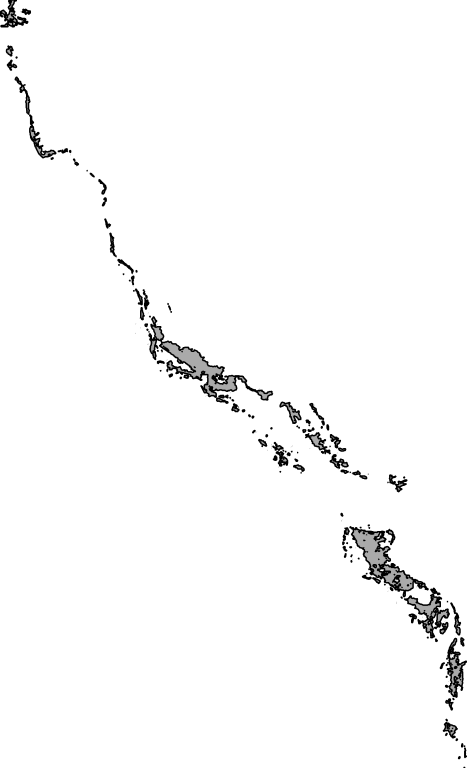
Outlines of islands and reefs in the Torres Strait region. Generated as a layer to use in the eAtlas web-portal, as a base map layer.
-
Information relating to Australian fisheries closures imposed by AFMA (Australian Fisheries Management Authority) and gazetted through ComLaw have been collated and tabulated with mapable GIS references in an ORACLE data base. This database allows searching, viewing and GIS mapping of the Australian spatial fisheries management through time. Mapping views of fisheries closures can be created for time, fisheries and gear types. Changes in spatial management through time will be mapable using a time-series of mapping views. The data is currently complete for the time-period of 2005 to Feb 2013. It is intended to continue this records as new gazettes are released as part of annual stock assessment updates. Non-fisheries closures (MPA, CMR) are also intended to be included but this is dependent on continued funding and demand for their use. Disclaimer: These data have been collated and made accessible for scientific research only, they may not be complete or representing the most up-to-date data. For the most recent spatial management arrangements for legal and commercial purposes, refer to the relevant current ComLaw documents or contact AFMA.
-
This resource describes a sample extent region for use in the Kaleidoscope spatial portal: https://kaleidoscope.terria.io/ No attribute data are presented.
-
This dataset represents Exclusive Economic Zones (EEZ) of the world. Up to now, there was no global public domain cover available. Therefore, the Flanders Marine Institute decided to develop its own database. The database includes two global GIS-layers: one contains polylines that represent the maritime boundaries of the world countries, the other one is a polygon layer representing the Exclusive Economic Zone of countries. The database also contains digital information about treaties. Please note that the EEZ shapefile also includes the internal waters of each country http://www.marineregions.org/eezmethodology.php
-
This project was developed for the Ningaloo Research Program (NRP) to explore the effects of managing recreational fishing, which is perhaps the most important extractive activities in the Ningaloo Marine Park. The project used simulation techniques known as Management Strategy Evaluation (MSE) to explore the consequences of a range of management actions, under a series of alternative future scenarios on the management of a major target species on Ningaloo Reef, spangled emperor (Lethrinus nebulosus). The results of the scenarios are examined against the objectives set out by management and other stakeholders in the park. A simulation model, known as ELFSim, was used. ELFSim is a decision support software system designed to evaluate options for conservation and harvest management, and includes a number of key components: a population dynamics model of target species that captures the full life history (including larval dispersal, reproduction, development, and habits) of the target species, a model of fishing dynamics that captures the exploitation pattern due to fishing behaviour, a management model that simulates the implementation of management actions. ELFSim was developed for other coral reef fisheries where commercial fishing was the primary fishing activity, and in this sought to develop a simulation model of recreational fishing dynamics. This model was agent-based, meaning that individual recreational fishing boats were represented in the model, and a range of management measures were tested on the ability to manage these virtual recreational fishers. These management measures, derived from stakeholder workshops include the effect of increasing the no-take sanctuary zones, and restricting the fishing in sanctuary zones that occurs from shore. The effectiveness of these management actions in the simulation model was measured against the management objectives of the stakeholders. Management objectives were classified according to ecological (conservation) objectives, or social and economic objectives. The results showed that the current management arrangement perform adequately against the range of ecological and social objectives. However, for other management actions, the results showed the inherent trade-off that exists between the ecological objective and the social objectives. For example, restricting fishing in sanctuaries from shore did well to achieve the conservation objectives, but did not achieve the social objectives as well as other management strategies. Imposing catch restrictions, increasing compliance monitoring and implementing an education program to reduce infringement also performed well against both social and ecological objectives, but consideration of effectiveness, and cost are uncertainties that our analysis did not consider. Such factors are likely to be extremely important and weighed in any realistic implementation of these management actions. Under the alternative scenarios the management strategy that was most likely to achieve the objectives was the hypothetical "Catch Limit" . The management strategy that allowed effort to increase was best at achieving the social objective of maximizing catches, including the catch of large fish. Although the simulations indicated that the "Catch Limit" strategy as an effective strategy for future alternative scenarios, in practice a combination of strategies limiting effort, or something else quite novel and resource intensive (like pink snapper tags in Freycinet Estuary in Shark Bay, WA for implementing a recreational Catch Limit), may need to be used for indirectly limiting the overall level of catch of spangled emperor from this sector. Of course such a strategy is also species specific and does not limit potential sustainability risks for other species. It is for this reason that DoFWA uses spangled emperor as an indicator species for the suite of demersal scalefish species in the Gascoyne Bioregion.