
cl_maintenanceAndUpdateFrequency
irregular
18 record(s)
Type of resources
Topics
Keywords
Contact for the resource
Provided by
Formats
Update frequencies
Status
draft
-
Monthly surveys of the continental shelf waters due west of Hillarys Marina (Perth, WA) were undertaken between October 1996 and December 1998, both to provide basic information on the water properties and as in situ validation of satellite SST and ocean colour data. Vertical temperature/salinity profiles were taken at each of the 9 stations across the 40-km transect, as well as depth-integrated nutrients and chlorophyll, light and optical properties, and phytoplankton and zooplankton samples. Surface temperature and fluorescence were recorded continuously across the transect.
-
The CSIRO O&A Catch Operations data set currently includes information on samples collected between 1965 and 2005 during voyages of various CSIRO research vessels. The data includes information about the time, location depth and catch method (trawl net etc) for each operation, metrics of catch (weight composition etc) and species and specimen details. Individual metadata records have been created for each research voyage. The data are held in the CSIRO Oceand and Atmosphere Data Warehouse, which currently holds over 13,000 catch operation records from more than 200 voyages.
-
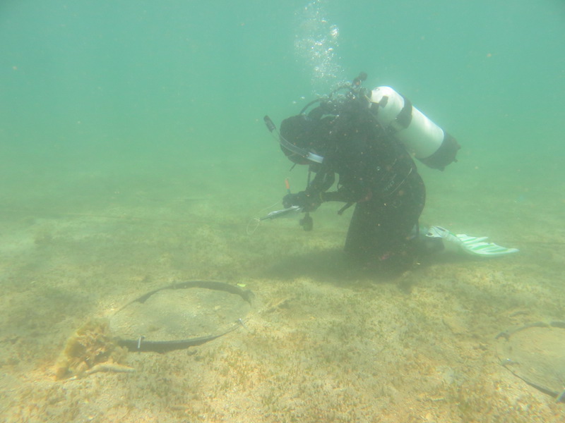
A) Rates of primary productivity for reef macroalgal and sediment microalgal communities will be determined from measurements of oxygen release (and/or CO2 consumption) collected from reef (3x) and bare sand/microphytobenthos (3x) communities using benthic chamber incubations. B) Nutrient enrichment experiments - response of macroalgae will be measured in terms of N assimilation in algal tissue, changes to species composition and changes in abundances. The response of consumers (abundance and other aspects of population dynamics, biomass, feeding biology and fecundity) will also be investigated, using video for mobile (fish) grazers, and quadrat sampling for less mobile grazers (eg. gastropods on reefs, urchins in sediments). Variations in the isotopic composition of the algae and consumers will be used to assess nutrient exposure and subsequent energy flow pathways into secondary production.
-
CMAR has conducted a number of stock assessment surveys for finfish, beche-de-mer and trochus on the reefs of Torres Strait. During the course of the suveys, habitat data was also collected albeit at a coarser level of taxonomic resolution. The primary objective of this study was to characterise the reefs of Torres Strait in terms of the biological and habitat data collected during these surveys and to relate the nature of the reefs to the available physical data. Information collated for this study included comprehensive datasets on reef fish, beche-de-mer and seagrass; most of which was identified to species level. Information on corals and algae was based on visual estimates of percentage cover morphotypes. Little data on the other reef biota was collected. SOURCE_DATASET CRUISE_ID CRUISE_NAME CRUISE_YEAR RRI1 HE01 Reef Resource Inventory HE01 1995 RRI2 HE02 Reef Resource Inventory HE02 1995 WR95 WRS Warrior survey 1995 1995 RRI3 JK01 Reef Resource Inventory JK01 1996 RRI4 JK02 Reef Resource Inventory JK02 1996 WR96 WRS Warrior survey 1996 1996 WR98 WRS Warrior survey 1998 1998 WR00 WRS Warrior survey 2000 2000 ETS2 ETS2 East Torres Strait 2002 2002 WE02 WRS Warrior survey 2002 2002 WR04 WRS Warrior survey 2004 2004 ETS5 ETS5 East Torres Strait 2005 2005
-
In 1997 and 1998, we tagged and released 18013 red-legged banana prawns in the Joseph Bonaparte Gulf. The location of recaptures was documented for 916 tagged prawns in 1997 and 512 tagged prawns in 1998. Tag recapture information and commercial fishery logbook information was used to test whether red-legged banana prawns moved continuously to deeper waters or whether they moved first to deep water but then returned to shallower waters. The analysis is based on compartment models of recaptures per unit of fishing effort.
-
The objective of Project 5.4 was to determine whether recovery of seagrass in the Pilbara following disturbance is by sexual (recruitment from seeds) or asexual (vegetative regrowth from rhizome extension) means, and the relative importance of each, thereby determining the capacity, timeframes and mechanisms of recovery from light and sediment deposition effects. This was achieved through an experiment in which plots cleared of seagrass were enclosed by a barrier or left open, and changes in cover were compared to unmanipulated control (and procedural control) plots. The experiment was done at two sites, a 2-m deep (the 'shallow' site) and a 6-m deep (the 'deep' site). The experiment was intended to run for 6 months, but after 5 months disturbance caused by Tropical Cyclone (TC) Olwyn reduced seagrass cover at both sites, and removed the experimental apparatus at the shallow site. Nevertheless, results yielded by surveys prior to TC Olwyn unambiguously showed strong evidence for recovery through vegetative regrowth (full recovery in cleared plots with no barriers, plus a pattern of increasing cover from the edges of the plots) and no evidence for recovery through recruitment from seeds (no seagrass was ever recorded in any cleared plot with a barrier). The main species of seagrass present was Halophila ovalis, which is widespread throughout northwestern Australia. The transferability of inferences from this study to other places in the Pilbara is hampered by the substantial variation in abundance and species composition from place to place - different species might have different mechanisms of recovery. The nature of the experimental disturbance (complete removal of all seagrass, including roots and rhizomes) is a reasonable facsimile of a severe dredging-induced disturbance, but the spatial extent of the experimental clearances (~0.5 m2) is orders of magnitude smaller than the spatial extents of dredging-induced mortality induced elsewhere: it is plausible that recovery of patches within meadows is more easily achieved through rhizome extension than recovery that encompasses spatial extents of hectares.
-
The eddy-resolving Ocean Forecasting Australia Model (OFAM) is used to downscale future climate projections by CSIRO Mk3.5 climate model under scenario A1B for the 2060s.
-
CARS is a set of seasonal maps of temperature, salinity, dissolved oxygen, nitrate, phosphate and silicate, generated using Loess mapping from all available oceanographic data in the region. It covers the region 100-200E, 50-0S, on a 1/2 degree grid, and on 56 standard depth levels. The data was obtained from the World Ocean Atlas 98 and CSIRO Marine and NIWA archives. It was designed to improve on the Levitus WOA98 Atlas, in the Australian region. **This CARS2000 is now superseded by CARS2006**
-
CARS is a set of seasonal maps of temperature, salinity, dissolved oxygen, nitrate, phosphate and silicate, generated using Loess mapping from all available oceanographic data in the region. CARS2006 covers the globe from 70S to 26N (only to 10N in the Atlantic), on a 1/2 degree grid, and on 79 standard (CSLv3) depth levels. The data was collated from many sources and rigorously screened to form BLUElink Ocean Archive (BOA). CARS2006 temperature and salinity fields are superseded by CARS2009, which has completely global fields.
-
CARS is a set of seasonal maps of temperature, salinity, dissolved oxygen, nitrate, phosphate and silicate, generated using Loess mapping from all available oceanographic data. CARS2009 covers the globe from 75S to 90N, on a 1/2 degree grid, and on 79 standard (CSLv3) depth levels. The data was collated from many sources and rigorously screened to form BLUElink Ocean Archive (BOA). CARS2009 supersedes the CARS2006. Everything you need to know, including a full set of plots and how to access from outside CSIRO, is at www.cmar.csiro.au/cars