Keyword
Global / Oceans | Southern Ocean/ Australia extension
43 record(s)
Type of resources
Topics
Keywords
Contact for the resource
Provided by
Formats
Update frequencies
Status
draft
-
This record describes a derived data set of museum records collated and quality assured in 2015 by Shirley Sorokin (SARDI), Franzis Althaus (CSIRO), Karen Gowlett-Holmes (CSIRO) and Jason Tanner (SARDI) under the GAB Research Program. The GABRP aims to describe the key elements of the GAB marine ecosystem. This understanding of the structure and function of the ecosystem will be used to inform future integrated and sustainable ocean management and assessment/mitigation of potential future impacts. The collation and examination of museum data contributed to our endeavor of documenting existing knowledge of species distributions in the GAB region. Museum database managers were asked to provide an inventory of all specimens listed in their respective data bases that were collected in Australian waters between Perth and Sydney at >=200 m depth. The data were collated and CAAB identifiers were added taking into account differences in spelling, synonyms (outdated names) etc. Where uncertainty in an identification existed the next higher level in the taxonomic hierarchy was used for assigning CAAB.
-

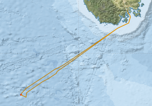
This record describes multibeam echosounder data collected on RV Investigator voyage IN2018_V07, SOTS: Southern Ocean Time Series Automated Moorings for Climate and Carbon Cycle Studies Southwest Tasmania which departed Hobart on the 20/08/2018 and returned to Hobart on the 25/08/2018. The Kongsberg EM710 MKII multibeam echosounder was used to acquire seafloor bathymetry and backscatter information between Hobart and the mooring deployment site. The EM710 MKII provides a 0.5° by 1° transmit and receive angular resolution respectively. The echosounder's nominal frequency range is from 40 to 100 kHz. Data are stored in *.all raw format for bathymetry and backscatter at CSIRO. There are 21 files totalling 2.27 GB of raw data in this dataset. Sound velocity profiles were applied to this data during data acquisition. Bathymetry data contained in *.all format are corrected for motion and position. Tide corrections were not applied to the processed data. Processed data has had outliers removed. Processed line data are available in *.gsf and ascii format, and processed bathymetry and backscatter grids in geotiff format. Additional information regarding this dataset, including further information on processing streams, is contained in the GSM data acquisition and processing report. Additional data products may be available on request.
-
This record describes Simrad SH90 high definition omnidirectional fishery sonar, 114 kHz data collected on RV Investigator voyage IN2019_V01, titled "The availability of Antarctic krill to large predators and their role in biogeochemical recycling in the Southern Ocean" which departed Hobart on the 19th January, 2019 and returned to Hobart on the 5th of March, 2019. The Simrad SH90 provides detailed information about school density, speed, depth, heading and size, with an operational frequency of 114 kHz. The SH90 was logged sporadically to guide krill fishing, and settings were updated/changed constantly with respect to angles and frequencies in real time to point to the krill schools while trawling. Data are stored in Simrad *.raw format at CSIRO. There are 12,861 files totalling 378 GB of raw data in this dataset. The data is available "as is" without any Quality Control measures, post processing or standardized settings. Additional information regarding this dataset, including the settings used, is contained in the GSM data acquisition and processing report. Additional data products may be available on request.
-

This record describes multibeam echosounder data collected on RV Investigator voyage IN2018_V05, 'How does a standing meander southeast of Tasmania brake the Antarctic Circumpolar Current?' which departed Hobart on the 16th October 2018 and returned to Hobart on the 16th November 2018. The objectives of the voyage included: (1) Deployment of a fleet of EM-APEX profiling floats, (2) Deployment of a tall mooring at the crest of a meander in the Polar Front of the Antarctic Circumpolar Current, (3) Full-depth hydrographic survey of the physics and biogeochemistry of the targeted ACC meander, conducting transects across the front and (4) Triaxus transects across and along the front. The Kongsberg EM710 MKII multibeam echosounder was used to acquire seafloor bathymetry and backscatter information during the departing transit from Hobart to a depth of around 1,177 m (at a position of 43.95°S; 147.78°E). The EM710 MKII provides a 0.5° by 1° transmit and receive angular resolution respectively. The echosounder's nominal frequency range is from 40 to 100 kHz. Data are stored in *.all raw format for bathymetry and backscatter at CSIRO. There are 12 files totalling 3.42 GB of raw data in this dataset. Sound velocity profiles were applied to this data during data acquisition. Bathymetry data contained in *.all format are corrected for motion and position. Tide corrections were not applied to the processed data. Processed data has had outliers removed. Processed line data are available in *.gsf and ascii format, and processed bathymetry and backscatter grids in geotiff format. Additional information regarding this dataset, including further information on processing streams, is contained in the GSM data acquisition and processing report. Additional data products may be available on request.
-

This record describes XBT data collected on RV Investigator voyage IN2018_V05, which departed Hobart on 16/10/2018, and arrived in Hobart on 16/11/2018. A total of 01 XBT casts were conducted over the duration of this voyage. The majority of T-S and speed of sound profiles were derived from 77 CTD casts that were undertaken during this voyage. Data are stored in netCDF files at CSIRO. Additional information regarding this dataset is contained in the GSM data acquisition and processing report. Additional data products may be available on request.
-

This record describes XBT data collected on RV Investigator voyage IN2020_V06 titled "Probing the Australian-Pacific Plate Boundary: Macquarie Ridge in 3-D." The voyage took place between October 8 and November 3, 2020 departing from Hobart (TAS) and arriving in Hobart (TAS). A total of 23 XBT casts were conducted over the duration of this voyage. Of these casts, 14 were considered acceptable, 4 were bad (failed or high SST) (i.e. 014, 015, 016, 019), 4 were good to only ~200 m (i.e. 003, 004, 005, 006) and 1 had no data at the start of the profile (i.e. 017). Data are stored in netCDF files at CSIRO. Additional information regarding this dataset is contained in the GSM data acquisition and processing report. Additional data products may be available on request.
-
This record describes ME 70 scientific multibeam fisheries echosounder data collected from the Marine National Facility (MNF) RV Investigator Voyage IN2020_V08, titled "SOLACE - Southern Ocean Large Areal Carbon Export: quantifying carbon sequestration in subpolar and polar waters." The voyage took place between December 5, 2020 and January 16, 2021 departing from Hobart (TAS) and arriving in Hobart (TAS). The Simrad ME70 scientific multibeam echosounder acquired acoustic backscatter data through the water column to 200m. The echosounder's frequency range is from 70 kHz to 120 kHz. The ME70 logged sporadically for the extent of the voyage. Data is stored in Simrad *.raw format at CSIRO. There are 273 files totalling 41.2 GB of raw data in this dataset. No processing has been conducted on this data. Additional information regarding this dataset, including the settings used, is contained in the GSM data acquisition and processing report. Additional data products may be available on request.
-
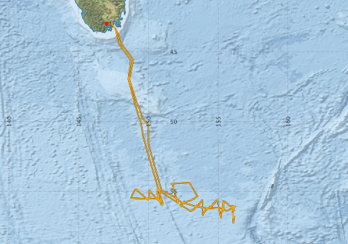
This record describes XBT data collectedfrom the Marine National Facility (MNF) RV Investigator Voyage IN2020_V08, titled "SOLACE - Southern Ocean Large Areal Carbon Export: quantifying carbon sequestration in subpolar and polar waters." The voyage took place between December 5, 2020 and January 16, 2021 departing from Hobart (TAS) and arriving in Hobart (TAS). A total of 30 XBT casts were conducted over the duration of this voyage. Data are stored in netCDF files at CSIRO. Additional information regarding this dataset is contained in the GSM data acquisition and processing report. Additional data products may be available on request.
-
This record describes sub bottom profiler data collected from the Marine National Facility (MNF) RV Investigator Voyage IN2020_V01, titled: “Development of William’s Ridge, Kerguelen Plateau: tectonics, hotspot magmatism, microcontinents, and Australia’s Extended Continental Shelf” between January 08 and March 06, 2020 departing from Henderson (WA) and returning back to Fremantle (WA). The Kongsberg SBP120 (sub bottom profiler) was used to acquire data containing the specular reflections at different sediment interfaces below the seafloor. The SBP120 provides a 3° by 3° angular resolution. The echosounder's frequency sweep range is from 2.5 to 7 kHz. The SBP120 was logged continuously for the extent of the voyage. Data are stored in *.raw (972 files 17.7 GB) raw and *.seg (996 files 18.2 GB) segy formats at CSIRO. The segy format data had a real time processing stream applied, which applies gain, a gain correction, matched filter with replica shaping, an attribute calculation for instantaneous amplitude and time variable gain. Additional information regarding this dataset is contained in the GSM data acquisition and processing report. Additional data products may be available on request
-
This record describes XBT data collected from the Marine National Facility (MNF) RV Investigator Voyage IN2020_V01, titled: “Development of William’s Ridge, Kerguelen Plateau: tectonics, hotspot magmatism, microcontinents, and Australia’s Extended Continental Shelf” between January 08 and March 06, 2020 departing from Henderson (WA) and returning back to Fremantle (WA). A total of 43 XBT casts were conducted over the duration of this voyage. Data are stored in netCDF files at CSIRO. Additional information regarding this dataset is contained in the GSM data acquisition and processing report. Additional data products may be available on request.
