Format
DIGITAL - Text Documents - MS Word
17 record(s)
Type of resources
Topics
Keywords
Contact for the resource
Provided by
Formats
Update frequencies
Status
draft
-
A) Rates of primary productivity for reef macroalgal and sediment microalgal communities will be determined from measurements of oxygen release (and/or CO2 consumption) collected from reef (3x) and bare sand/microphytobenthos (3x) communities using benthic chamber incubations. B) Nutrient enrichment experiments - response of macroalgae will be measured in terms of N assimilation in algal tissue, changes to species composition and changes in abundances. The response of consumers (abundance and other aspects of population dynamics, biomass, feeding biology and fecundity) will also be investigated, using video for mobile (fish) grazers, and quadrat sampling for less mobile grazers (eg. gastropods on reefs, urchins in sediments). Variations in the isotopic composition of the algae and consumers will be used to assess nutrient exposure and subsequent energy flow pathways into secondary production.
-

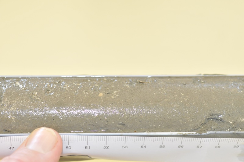
The remote Kimberley coast of north-western Australia is one of the few marine environments domains on earth largely unaffected by human use. However, the region is undergoing increasing economic importance as a destination for tourism and significant coastal developments associated with oil and gas exploration. The objective of the project was to reconstruct a timeline of inferred water quality changes from the sediment record for a selected set of sites in the Kimberley, Western Australia. The project made use of palaeoecological approaches to reconstruct a chronology of change over the last approximately 100 years using a series of biogeochemical proxies for phytoplankton composition and biomass, temperature and terrestrial influences. Where possible these were matched to historical land/water use, meteorological or hydrological observational records. The project examined sediment cores from three coastal locations, Koolama Bay (King George River), Cygnet Bay and Roebuck Bay. Each sampling location provided a contrast with which to evaluate changes over either a spatial or temporal gradient of human or natural influence. Sediment cores (up to 1.5 m) were obtained from each of these locations in the expectation that they would provide a time series for about the last 100 years. A set of parameters was measured along the core length (every 1-2 cm) for some or all cores depending on the particular focus for the location: 210Pb and 137Cs; 15N isotope; 13C isotope; Carbon/Nitrogen ratio; Sedimentation rate and grain size; Total Organic Carbon (TOC) and Total Nitrogen (TN); Biosilicate; Biomarkers; TEX86; long chain n-alkanes (C27+C29+C31); Elemental carbon (or black carbon). Rainfall data was obtained from the Australian Bureau of Meteorology website (www.bom.gov.au). Stream flow data was obtained from the Western Australian Department of Water website (www.water.wa.gov.au). Historical bushfire data was obtained from the Western Australian Department of Parks and Wildlife. The metadata record only relates to data generated as part of the sediment analysis.
-
Two types of fish distribution data were sought for this study: point data or specimen data, and catch composition data. Data were obtained from oceanographic surveys by State and Australian Government research vessels, plus a few surveys from Australian commercial and foreign vessels. These data were used to construct a biogeographic framework from regionalisations of the continental slope of Australia's marine jurisdiction, based on the distributional patterns of the region's demersal fish fauna. Thousands of specimens were re-identified to secure accurate distribtions. Offshore demseral fishes are defined as those occurring below a depth of 40 metres. Historical data used, which does not adequately cover the entire region.
-

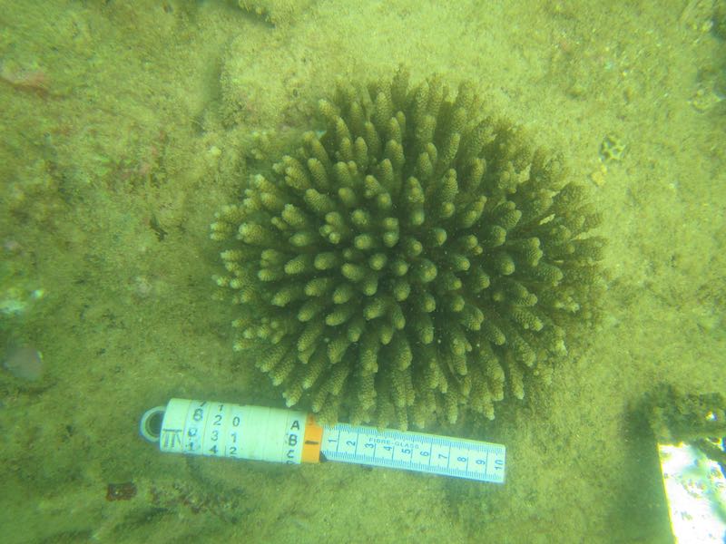
An understanding of coral population dynamics (demography) is needed when designing and evaluating studies that aim to detect the effects of natural and anthropogenic mediated impacts on coral communities, and in particular when making predictions about the likelihood of and speed of recovery from such impacts. This study was undertaken to gather baseline data on demographic processes to improve our understanding of the fundamental population dynamics in relation to recruitment, growth and survival of reef building corals in the Pilbara. Measurements of key demographic processes were carried out annually over two years (April 2014 and March 2015) at Enderby and West Lewis Islands in the Dampier Archipelago, Western Australia. Locations sampled at Dampier Archipelago (where coral populations existed) were relatively unimpacted by bleaching mortality that occurred between 2011-2014. At each location permanent transects were established sufficient to provide up to several hundred tagged colonies in order to derive valid demographic rates (growth, mortality, shrinkage, fragmentation) for individuals of each size class, as well as to allow estimates of recruitment. Censuses were conducted using a combination of wide angle photographs of the permanent transects, detailed field censuses of recruits and adult corals, and direct measurements of tagged colonies. The corals investigated in this study were Acropora millepora, Turbinaria mesenterina and massive Porites spp. (mainly P. lobata and P. lutea). These species were chosen because they were among the most common coral taxa on reefs of the Pilbara, and on many reefs globally, making them fundamental to reef primary productivity and carbonate accretion, and because they have contrasting life histories and susceptibilities to disturbances.
-
This study examined the cultural acceptability of various management options for dugongs and green turtles at Hammond Island in Torres Strait. Elders and hunters participated in semi-structured interviews to examine their perceptions about various management options for dugongs and green turtles for their community.
-
Project Overview: A range of solutions will be required to reach globally agreed emissions reductions targets for carbon dioxide (CO2). Carbon capture and storage (CCS) is part of the suite of technologies that will contribute to lowering atmospheric emissions of CO2 from Australia's energy system. There are a wide variety of technologies at various stages of technical and commercial readiness, with more development underway for cost effective CO2 capture and storage. Our research will provide new knowledge to inform cost-efficient measurement, monitoring and verification (MMV) of the environment of CCS projects in coastal waters. --o-- Four 10 cm and four 6 cm diameter sediment cores were collected at each of the study sites in the Gippsland area, Victoria. Cores were collected by hand and involved divers pushing the core into the sediment to a depth of 10 cm depth and capping the core at both ends using rubber stoppers. At each site 4 cores of each size were collected for bacteria and infauna, replicated on 2 spatial scales, 1 m apart and 10 m apart. Sediment cores have been processed and analysed for infaunal diversity and abundance (top 10 cm of caore), bacteria DNA (0-2 cm core depth and 8-10 cm core depth) and infauna DNA (top 10 cm of cores); XRD, TC/TOC/TN and particle size will be analysed for some cores.
-
The content and composition of the oil from nearly 200 species of Australian fish, shellfish and crustaceans were examined. The nutritional value of Australian species was determined with respect to oil composition, as was how oil content may differ with geographical region, taxonomic group and other factors. This knowledge has been transferred, in various formats, to the Fishing Industry, nutritionists and other consumer groups to better utilize the total catch, including waste products.
-
Muirfield section of Franklin cruise FR07/99 consisting of biological station logs, tow profiles of video system, general background information and report in electronic form.
-
ESRI grids showing phytoplankton provinces around Australia. The information was supplied by Dr Gustaaf Hallegraeff, of the University of Tasmania in 2004 as an update of the Jeffrey/Hallegraeff 1991 phytoplankton map. Variations in onscreen colour representation or printed reproduction may affect perception of the contained data.
-
This record references the database of the final data from the Huon Estuary Study. The data from the project's access database has been transfered into an oracle database which is available on-line to project members. The access database tables have also been exported to text files for archiving to cdrom (held in CMR Data Centre-May 2004.) Data Dictionary files have also been stored on cdrom along with technical reports which describe the data modelling undertaken for the project. The database contains ammonia, arsenic, ctd header, dissolved oxygen, mercury, nutrient, organic matter, pigment, salinity, sediment, suspended solids, taxon counts and dominance data in their final processed form. Data in the database was collected at 61 stations on a seasonal regime (HES Surveys) Weekly/fortnightly (CM Surveys)at 5 of those stations. A sediment survey in May 1997 (SED1) and a Contaminants Survey in August/September 1998 (HES10A) were also carried out. The study was undertaken over the period 1996-1998. Refer to the other Huon Estuary Study metadata records to explore datasets which were not loaded into the database such as the ctd, snapshot and moored instrument data.
