
Keyword
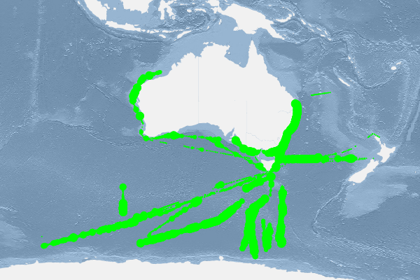
Research Voyage: IN2021_V01
17 record(s)
Type of resources
Topics
Keywords
Contact for the resource
Provided by
Formats
Update frequencies
Status
draft
-
AusCPR: Phytoplankton Abundance. The Australian Continuous Plankton Recorder (AusCPR) survey is a joint project between CSIRO Oceans and Atmosphere (O&A) and the Australian Antarctic Division (AAD) to measure plankton communities as a guide to the health of Australia's oceans. The phytoplankton abundance data are analysed as per Richardson et al 2006. Phytoplankton are usually counted from water samples after settling but in the CPR analysis we count the phytoplankton in situ. With CPR samples, the phytoplankton is captured by the mesh and are caught by the silk strands, by phytoplankton mucilage, and/or by other organisms on the silk. It is thus possible to see the phytoplankton cells directly on the mesh. In essence, the phytoplankton is already concentrated. Washing the phytoplankton off the silks to count in the standard manner may result in loss of or damage to cells before analysis. It is advised that anyone using the data should first read this methodology or contact the project contact person. The aims of the AusCPR survey are to: * map plankton biodiversity and distribution * develop the first long-term plankton baseline for Australian waters * document plankton changes in response to climate change * provide indices for fisheries management * detect harmful algal blooms * validate satellite remote sensing * initialise and test ecosystem models. Servicing and maintenance of the CPRs and analysis of the samples for the AusCPR survey will be carried out by staff based at the O&A laboratories in Queensland and at the AAD in Hobart. The project was funded by the Integrated Marine Observing System (IMOS) and falls with the Ships of Opportunity facility. Data storage and access is planned to be interoperable with other national and international programs through the IMOS Infrastructure. Results from the AusCPR survey are available through the AODN portal: https://portal.aodn.org.au. For information on using the data please refer to the Richardson et al. 2006. As the taxonomic resolution of the data has changed over time, due to continual training, it is important that users refer to the change log tables included in your data download. These will provide information on the validity of the taxa, from what date we have been identifying certain taxa etc. Classification fields may be blank depending on the level to which that taxa has been identified, i.e. if only identified to family, genus and species will be blank. This data is freely available but please acknowledge all relevant parties, as detailed in acknowledgement section.
-

This record describes multibeam echosounder data collected on RV Investigator voyage IN2021_V01, titled: "Quantifying krill abundance for krill monitoring and management off the Australian Antarctic Territory," which departed Hobart on the 29th January 2021 and returned to Hobart on the 24th March 2021 (AEST). The Kongsberg EM710 MKII multibeam echosounder was used to acquire seafloor bathymetry, backscatter information and watercolumn backscatter for only a short duration at the beginining of the voyage, followed by two short periods to assess mooring deployment locations. Mooring deployment site surveys carried out with the EM710 MKII were in the vicinity of the Antarctic shelf-break region with locations of approx. 66°57.2'S, 75°00.5'E & 66°32'S, 62°13'E. The EM710 MKII provides a 0.5° by 1° transmit and receive angular resolution respectively. The echosounder's nominal frequency range is from 40 to 100 kHz. Data are stored in *.all raw format for bathymetry and backscatter and *.wcd format for watercolumn backscatter at CSIRO. There are 47 files totalling 15.82GB of raw data in this dataset. Sound velocity profiles were applied to this data during data acquisition. Bathymetry data contained in *.all format are corrected for motion and position. The data have been reduced to approximate Mean Sea Level (MSL) using the Earth Gravitation Model 2008 (EGM2008) 1 arc-minute grid. Tide corrections were not applied to the processed data. Processed data has had outliers removed. Processed line data are available in *.gsf and ascii format, and processed bathymetry and backscatter grids in geotiff format. Additional information regarding this dataset, including further information on processing streams, is contained in the GSM data acquisition and processing report. Additional data products may be available on request.
-
This record describes ME 70 scientific multibeam fisheries echosounder data collected on RV Investigator voyage IN2021_V01, "Quantifying krill abundance for krill monitoring and management off the Australian Antarctic Territory", which departed Hobart on the 29th January 2021 and returned to Hobart on the 24th March 2021 (AEST). The Simrad ME70 scientific multibeam echosounder acquired acoustic backscatter data through the water column to 300 metres. The echosounder's frequency range is from 70 kHz to 120 kHz. The ME70 logged continuously for the majority of the voyage. Data are stored in Simrad *.all raw format at CSIRO. There are 13,322 files totalling 891 GB of raw data in this dataset. No processing has been conducted on this data. Additional information regarding this dataset, including the settings used, is contained in the GSM data acquisition and processing report. Additional data products may be available on request.
-
This record describes gravity data collected on RV Investigator voyage IN2021_V01, "Quantifying krill abundance for krill monitoring and management off the Australian Antarctic Territory", which departed Hobart on the 29th January 2021 and returned to Hobart on the 24th March 2021 (AEST). The gravity meter instrument is a MicroG Lacoste Air-Sea II. Data are stored in .ENV and .DAT data files at CSIRO. There are 98 files totalling 785 MB of raw data in this dataset. No data was acquired between 15:15 on 01/02/2021 and 14:59 on 06/02/2021 (UTC) and between 16:27 on 17/03/2021 and 04:19 on 20/03/2021 (UTC) due to rough weather conditions requiring the system to be turned off. No processing has been conducted on this data. Additional information regarding this dataset is contained in the GSM data acquisition and processing report.
-
This record describes sub bottom profiler data collected on RV Investigator voyage IN2021_V01, titled: "Quantifying krill abundance for krill monitoring and management off the Australian Antarctic Territory," which departed Hobart on the 29th January 2021 and returned to Hobart on the 24th March 2021 (AEST). The Kongsberg SBP120 (sub bottom profiler) was used to acquire data containing the specular reflections at different sediment interfaces below the seafloor. The SBP120 provides a 3° by 3° angular resolution. The echosounder's frequency sweep range is from 2.5 to 7 kHz. The SBP120 was logged [continuously/sporadically] for the extent of the voyage. Data are stored in *.raw (972 files 16.8 GB) raw and *.seg (7024 files 5.35 GB) segy formats at CSIRO. The segy format data had a real time processing stream applied, which applies gain, a gain correction, matched filter with replica shaping, an attribute calculation for instantaneous amplitude and time variable gain. Additional information regarding this dataset is contained in the GSM data acquisition and processing report. Additional data products may be available on request
-
This record describes XBT data collected on RV Investigator voyage IN2021_V01, "Quantifying krill abundance for krill monitoring and management off the Australian Antarctic Territory", which departed Hobart on the 29th January 2021 and returned to Hobart on the 24th March 2021 (AEST). A total of 110 XBT casts were logged over the duration of this voyage. Of these, 92 were successful and 18 casts were considered failed. Data are stored in netCDF files at CSIRO. Additional information regarding this dataset is contained in the GSM data acquisition and processing report. Additional data products may be available on request.
-
This record describes multibeam echosounder data collected on RV Investigator voyage IN2021_V01 titled: "Quantifying krill abundance for krill monitoring and management off the Australian Antarctic Territory," which departed Hobart on the 29th January 2021 and returned to Hobart on the 24th March 2021 (AEST). The Kongsberg EM122 multibeam echosounder was used to acquire seafloor bathymetry, backscatter information and watercolumn backscatter on the transit to the survey site and also preiodically during CTD operations. The EM122 provides a 1 degree by 1 degree angular resolution. The echosounder's nominal frequency is 12 kHz. Data are stored in *.all raw format for bathymetry and backscatter and *.wcd format for watercolumn backscatter at CSIRO. There are 1864 files totalling 109.2 GB of raw data in this dataset. Sound velocity profiles were applied to this data during data acquisition. Bathymetry data contained in *.all format are corrected for motion and position. The data have been reduced to approximate Mean Sea Level (MSL) using the Earth Gravitation Model 2008 (EGM2008) 1 arc-minute grid. Tide corrections were not applied to the processed data. Processed data had outliers removed. Processed line data are available in *.gsf and ascii format, and processed bathymetry and backscatter grids in geotiff format. Additional information regarding this dataset, including information on processing streams, is contained in the GSM data acquisition and processing report. Additional data products may be available on request.
-
This record describes scientific split-beam echosounder data collected on the RV Investigator voyage IN2021_V01, "Quantifying krill abundance for krill monitoring and management off the Australian Antarctic Territory", which departed Hobart on the 29th January 2021 and returned to Hobart on the 24th March 2021 (AEST). The Simrad EK80 split beam echosounders 18, 38, 70 120, 200 and 333 kHz were used to acquire acoustic backscatter data to a maximum range of 1500 m between Hobart and near Mawson station, Antarctica. All frequencies were logged continuously for the extent of the voyage. Acquisition settings (pulse length, power) were varied for the transit and survey portions of the voyage according to science requirements. Specific settings for each time period can be obtained from the GSM voyage report. From 1 Feb, 2021 the 18kHz WBT was replaced with the 18kHz GPT which was run for the remainder of the voyage. A calibration was performed at the survey location on 13 Feb 2021. Data are stored in *.raw, *.bot and *.idx format at CSIRO. There are 3192 files totalling 295 GB of raw data in this dataset. No processing has been conducted on this data. Additional information regarding this dataset is contained in the GSM data acquisition and processing report. Additional data products may be available on request.
-
This record describes the Acoustic Doppler Current Profiler (ADCP) data collected from the Marine National Facility RV Investigator voyage IN2021_V01, titled: "Quantifying krill abundance for krill monitoring and management off the Australian Antarctic Territory". The voyage took place from Hobart (TAS) to Hobart between January 29 and March 24, 2021. Both the RDI Ocean Surveyor 150kHz ADCP and the RDI Ocean Surveyor 75kHz ADCP were run in narrowband for transit to and from the survey area. During survey transects the OS150 was used. Data was collected using UHDAS and post-processed using CODAS. Internal triggering was used for the transits to and from the survey site only. When run on transect lines or during target trawling, triggering was performed via KSYNC, synchronised to the EK80 with a ping frequency between 1 and 2.5 seconds. Please see the voyage computing and electronics report for more details regarding operation. This dataset was processed and then archived within the CSIRO National Collections and Marine Infrastructure (NCMI) Information and Data Centre (IDC) in Hobart.
-
This record describes Hydrology (HYD) data collected from the Marine National Facility RV Investigator voyage IN2021_V01, titled: "Quantifying krill abundance for krill monitoring and management off the Australian Antarctic Territory." The voyage took place between January 29 and March 25, 2021 departing from Hobart (TAS) and arriving in Hobart. . Water samples collected during the voyage were analysed in the ship’s hydrochemistry laboratory for nutrients, dissolved oxygen, and salinity. Five nutrients were determined: silicate, phosphate, nitrate + nitrite, nitrite and ammonium. Certified reference materials for nutrients in seawater (RMNS) were within 3% of their certified values. CTD deployment versus measured RMNS values are listed in Appendix 8.2 Missing and suspect hydrology data are listed in Appendix 8 Final hydrology data, analytical methods, related log sheets and processing notes can be obtained from the CSIRO data centre. This dataset has been archived at the CSIRO National Collections and Marine Infrastructure (NCMI) Information and Data Centre (IDC) in Hobart. Additional information regarding this dataset is contained in the Voyage Report and Data Processing Report.