
Keyword
Earth Science | Climate Indicators | Atmospheric/Ocean Indicators | Temperature Indices | Heating Degree Days
3 record(s)
Type of resources
Topics
Keywords
Contact for the resource
Provided by
Formats
Update frequencies
Status
draft
-
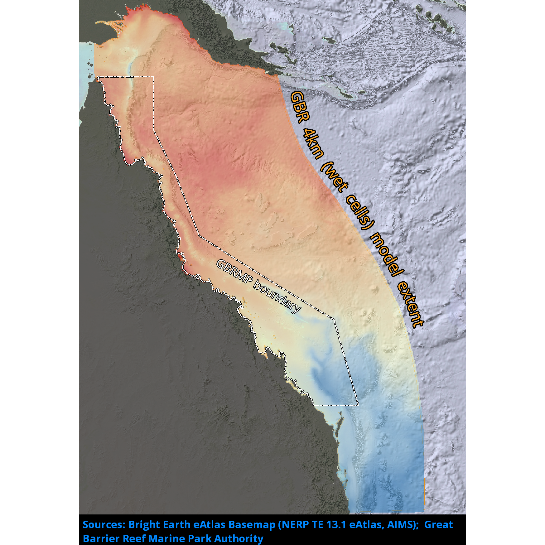
Results from version 2.0 of the 4km-resolution regional-scale hydrodynamic model of the Great Barrier Reef (GBR4). This model was forced with BlueLink Ocean Modelling and Prediction System (OceanMAPS) model results on the ocean boundaries and Bureau of Meteorology ACCESS-R model for surface atmospheric data. The tide was introduced through 22 constituents derived from the global CSR tide model, and the river boundaries incorporate measured stream flow and temperature data from QLD DNRM's gauging stations for 22 rivers, and estimated flows and loads for 49 additional rivers. There were no known forcing problems. This model configuration and associated results dataset may be referred to as "GBR4_H2p0" according to the eReefs simulation naming protocol. The model ran in near-real-time mode, updating daily, until January 2024 when the 2023/24 monsoon season caused damage to sensors in the catchments, and we lost access to the critical river-flow forcing dataset.
-
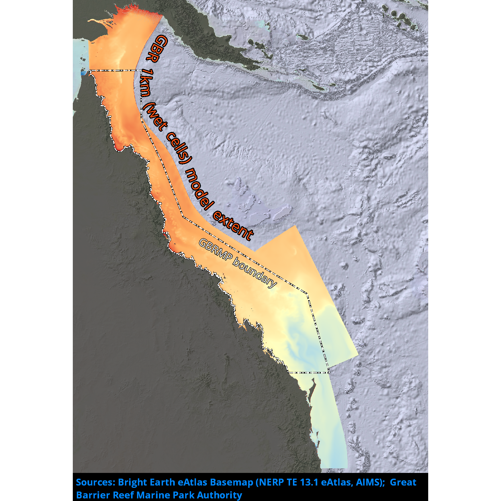
Results from version 2.0 of the 1km-resolution shelf-scale hydrodynamic model of the Great Barrier Reef (GBR1). This model is nested within version 2.0 of the 4km-resolution hydrodynamic model (GBR4) data at the ocean boundaries, used the Bureau of Meteorology ACCESS-R model for surface atmospheric data and incorporated measured flow data from gauging stations at the river boundaries from QLD DNRM. This model configuration and associated results dataset may be referred to as "GBR1_H2p0" according to the eReefs simulation naming protocol. The model ran in near-real-time mode, updating daily, until January 2024 when the 2023/24 monsoon season caused damage to sensors in the catchments, and we lost access to the critical river-flow forcing dataset.
-
Results from version 4.0 of the 4km-resolution regional-scale hydrodynamic model of the Great Barrier Reef (GBR4). This model is forced with: 1. Surface Atmospheric Data: Bureau of Meteorology Atmospheric high-resolution Regional Reanalysis for Australia, using Data Assimilation of Quality Control observations (BARRA); 2. Ocean Boundaries: CSIRO Bluelink Reanalysis using Data Assimilation of Quality Control observations (BRAN2020) model results; 3. Tide: global TPXO tide model; 4. River boundaries: measured stream flow and temperature data for 64 rivers from a combination of the Bureau of Meteorology Grid 2 Grid catchment model (G2Gv3) and the QLD DES Source catchment model. This model configuration and associated results dataset may be referred to as "GBR4_H4p0_ABARRAr2_OBRAN2020_FG2Gv3_Dhnd" according to the eReefs simulation naming protocol. The model ran in hindcast mode and is complete. It succeeds the GBR4_H2p0 model as the best available eReefs hydrodynamic model results for its timespan.