
Keyword
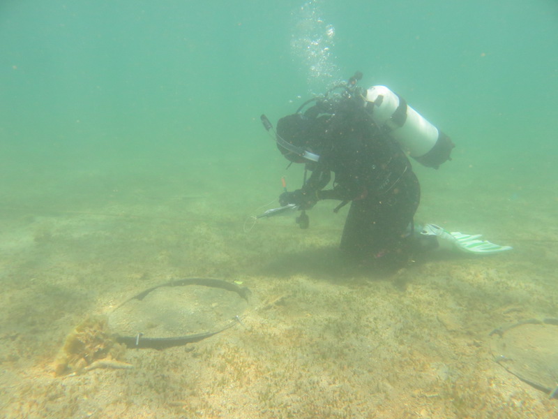
Water Column Samplers
20 record(s)
Type of resources
Topics
Keywords
Contact for the resource
Provided by
Formats
Update frequencies
Status
draft
-
This dataset contains nutrient, temperature, salinity, chlorophyll a, suspended solids and light data from Jervis Bay, NSW. The data were obtained from 9 sites around Jervis Bay, every 3 months between 1989 and 1991. Data from monthly sampling for 2 years from 5 sites were also obtained. The data are part of the Jervis Bay Marine Ecological Study. NB - As the database has been lost, the only data still available are those published in the JERVIS BAY BASELINE STUDIES Final Report.
-
The objective of Project 5.4 was to determine whether recovery of seagrass in the Pilbara following disturbance is by sexual (recruitment from seeds) or asexual (vegetative regrowth from rhizome extension) means, and the relative importance of each, thereby determining the capacity, timeframes and mechanisms of recovery from light and sediment deposition effects. This was achieved through an experiment in which plots cleared of seagrass were enclosed by a barrier or left open, and changes in cover were compared to unmanipulated control (and procedural control) plots. The experiment was done at two sites, a 2-m deep (the 'shallow' site) and a 6-m deep (the 'deep' site). The experiment was intended to run for 6 months, but after 5 months disturbance caused by Tropical Cyclone (TC) Olwyn reduced seagrass cover at both sites, and removed the experimental apparatus at the shallow site. Nevertheless, results yielded by surveys prior to TC Olwyn unambiguously showed strong evidence for recovery through vegetative regrowth (full recovery in cleared plots with no barriers, plus a pattern of increasing cover from the edges of the plots) and no evidence for recovery through recruitment from seeds (no seagrass was ever recorded in any cleared plot with a barrier). The main species of seagrass present was Halophila ovalis, which is widespread throughout northwestern Australia. The transferability of inferences from this study to other places in the Pilbara is hampered by the substantial variation in abundance and species composition from place to place - different species might have different mechanisms of recovery. The nature of the experimental disturbance (complete removal of all seagrass, including roots and rhizomes) is a reasonable facsimile of a severe dredging-induced disturbance, but the spatial extent of the experimental clearances (~0.5 m2) is orders of magnitude smaller than the spatial extents of dredging-induced mortality induced elsewhere: it is plausible that recovery of patches within meadows is more easily achieved through rhizome extension than recovery that encompasses spatial extents of hectares.
-

The Theme 5.3 study was undertaken to improve our understanding of the spatial and temporal patterns in seagrass composition, abundance and reproductive phenology in the Pilbara region. Key environmental parameters, especially light, that influence seagrass survival and can be altered by dredging were also characterised. From August 2013 to March 2015 (18 months), surveys of seagrass abundance were undertaken in the Exmouth Gulf region. The locations surveyed (South Muiron Island, Bundegi and Exmouth Gulf) encompassed a range in water clarity from clear to turbid. Less frequent surveys were undertaken at other locations in the Pilbara: Thevenard Island, Rosemary Island and Balla. Measurements of seagrass abundance were also obtained from monitoring conducted as part of the dredging and dredge-spoil management plan for Chevron Australia's Wheatstone Liquefied Natural Gas (LNG) Project. During each survey measurements were made in the field, photographs were taken or samples were collected in order to measure the following variables: 1. percentage cover of seagrass and other benthos; 2. above- and below-ground biomass, shoot density, leaf length, leaf width and number of flowers; 3. density of seagrass seeds; 4. sediment grain size; 5. stable isotope ratios (Ô13C and Ô15N) of seagrass leaf tissue; and 6. water quality (light, conductivity, temperature, salinity, nutrients, suspended particulate matter and chlorophyll).
-
These data are the result of Geoscience Australia survey 266 to the central Torres Strait region, with the survey being the first of two by Geoscience Australia carried out in 2004. They form part of a larger field-based program managed by the Torres Strait CRC aimed at identifying and quantifying the principal physical and biological processes operating in Torres Strait. The impetus for the program is the threat of widespread seagrass dieback and its effects on local dugong and turtle populations and the implications for indigenous islander communities. The principal aim of the survey was to investigate the seabed geomorphology and sedimentary processes in the vicinity of Turnagain Island and to infer the possible effects (if any) on the distribution, abundance and survival of seagrasses. The Turnagain Island region was chosen because it is a known site of recent widespread seagrass dieback. The survey consisted of a detailed geophysical survey using swath (multi-beam) sonar and shallow seismic equipment that was supplemented with a detailed sampling program consisting of 301 near-bed water samples, 54 seabed grabs, 5 vibrocores and 69 camera stations. Four oceanographic moorings were also deployed for the duration of the survey to measure the local tide, wave and wind-driven currents. A regional survey was initially undertaken, followed by a detailed study of two areas: Area A - located approximately 2.5 km SW of Turnagain Island which contained sand ridges and seagrass beds, and Area B - located approximately 2.0 km SE of Turnagain Island which contained sandwaves and no seagrass beds. In a new application of the swath (multi-beam) data, the total volume of sediment transported during the survey was estimated from changes in the high-resolution seabed bathymetry collected during the repeat surveys. Preliminary results of the study found that seagrasses in the region are subject to frequent and significant changes in environmental conditions, with implications for limited dispersal and survival. A follow-up survey was undertaken in October 2004.
-
BOA is the result of collecting together the majority of global high-quality buoy and shipboard deepwater hydrographic cast data. It is built on the NOAA/NODC World Ocean Database (BOA06 uses WOD01), WOCE WHP3, Argo, TAO, CSIRO and NIWA archives, and a number of other sources. The component datasets of BOA are stored separately in a range of formats since the nature of these datasets is quite varied. This approach allows easy updating of components (for example, the Argo subset is completely renewed every couple of months.) Where the same data could reside in multiple datasets, those datasets are duplicate cross-checked after any updates (scanning only on the basis of time and location, not the enormous task of searching for duplicated property profiles.). BOA is available in a packaged form of one netCDF file per property (created in July 2006.) Neutral density profiles are also computed and stored in file gamma_BOA06.nc. These files are available via an OpenDAP server and for internal use as local netCDF files.
-
The Aquafin CRC Salmon Project is being undertaken by CSIRO Marine and Atmospheric Research (CMAR) and Tasmanian Aquaculture and Fisheries Institute (TAFI). Process Study 1 was undertaken between 12-14 April 2005 in the Huon Estuary offshore from Hideaway Bay. Prior to each microheterotroph grazing experiment, a CTD cast was performed at site P3 using the Seaboard 4550 to determine the depth of the fluorescence maximum. Water for a grazing experiment was collected from a depth of 20m (12 April) and 5m (13 April).
-
The Aquafin CRC Salmon Project is being undertaken by CSIRO Marine and Atmospheric Research (CMAR) and Tasmanian Aquaculture and Fisheries Institute (TAFI). Prior to the three microheterotroph grazing experiments, a CTD cast was performed at site PE3 to determine the depth of the fluorescence maximum. Water for the three grazing experiments was collected simultaneously from a depth of 7m. For all three experiments, the sample water was filtered through a 200µm mesh as usual. For the second experiment, 10 mesozooplankton were added to the sample water in each incubated bottle. In the third experiment 30 additional mesozooplankton were added to the sample water in each incubated bottle. The additional mesozooplankton were removed from the incubated bottles at the close of the experiment, before filtration. Samples were incubated for 24 hours with subsamples collected at times T0 and T24 for phytoplankton and microheterotroph counts, nutrient analysis and pigment concentration and composition. Grazing and growth rates were calculated.
-
The Aquafin CRC Salmon Project is being undertaken by CSIRO Marine and Atmospheric Research (CMAR) and Tasmanian Aquaculture and Fisheries Institute (TAFI). Monthly Monitoring 1 (MM1) was undertaken in the D'Entrecasteaux Channel by CMAR and in the Huon River by TAFI from 10 January 2002 until 31 March 2003. During MM1 samples were collected monthly from 12 sites in the D'Entrecasteaux Channel by CMAR for the analysis of nutrients, phytoplankton species identification, and chlorophyll a; samples were collected for salinity calibration and dissolved oxygen approximately four times a year from 3 sites. In December 2002, samples were collected for HPLC pigment analysis from 5 sites. Samples were collected monthly from 4 sites in the Huon River by TAFI for phytoplankton species identification, nutrients, spectrophotometric chlorophyll a and dissolved oxygen. This metadata record refers to the Monthly Monitoring 1 data collected by CMAR in the D'Entrecasteaux Channel. Two depths were sampled (0 and 1 m from the bottom) for the nutrient analyses, chlorophyll a analysis and dissolved oxygen. A 12 m integrated water column sample was collected for phytoplankton species identification and additionally for chlorophyll a analysis in the first 12 months of the monitoring. In December 2002, samples were collected from surface and bottom from 5 sites for HPLC pigment analysis. At each site prior to the collection of the samples a CTD profile to near bottom was collected using the SBE19-0605 and the Secchi depth measured. PLEASE NOTE - The phytoplankton results were updated in June 2012 with a correction. The original biovolume unit in column L and M was incorrect and should have been µL/L. The values in column M and L have been divided by 1000 and the unit mL/L left unchanged. Other values are not affected including CPL and Group CPL.
-
The Aquafin CRC Salmon Project is being undertaken by CSIRO Marine and Atmospheric Research (CMAR) and Tasmanian Aquaculture and Fisheries Institute (TAFI). Process Study 2 was undertaken between 21-22 September 2005 in the Huon Estuary offshore from Hideaway Bay. Prior to each microheterotroph grazing experiment, a CTD cast was performed at site P3 using the Seaboard 4550 to determine the depth of the fluorescence maximum. Water for a grazing experiment was collected from a depth of 2 m on the 21 September 2005 Samples were incubated for 24 hours with subsamples collected at times T0 and T24 for phytoplankton and microheterotroph counts, nutrient analysis and pigment concentration and composition. Grazing and growth rates were calculated.
-
The Aquafin CRC Salmon Project is being undertaken by CSIRO Marine and Atmospheric Research (CMAR) and Tasmanian Aquaculture and Fisheries Institute (TAFI). Monthly monitoring 2 (MM2) was undertaken in the Huon River and D Entrecasteaux Channel from 20 September 2004 until 19 October 2005, except that there was no sampling in May or July 2005. During MM2 samples were collected monthly from 11 sites for the analysis of nutrients, phytoplankton species identification, chlorophyll and carotenoid pigments and turbidity; samples were collected approximately every second month from 3-4 sites for dissolved oxygen (TAFI). Two depths were sampled (0 and 1 m from the bottom) for the nutrient analyses, dissolved oxygen and spectrophotometric chlorophyll (TAFI) and two depths were sampled for turbidity (1m and 5m). A 12 m integrated water column sample was collected for the CMAR HPLC pigment analysis and phytoplankton species identification. At each site prior to the collection of the samples a CTD profile to near bottom was collected using the SBE19-4550 and the Secchi depth measured. PLEASE NOTE - The phytoplankton results were updated in June 2012 with a correction. The original biovolume unit in column L and M was incorrect and should have been µL/L. The values in column M and L have been divided by 1000 and the unit mL/L left unchanged. Other values are not affected including CPL and Group CPL.