Keyword
Regional Seas
4 record(s)
Type of resources
Topics
Keywords
Contact for the resource
Provided by
Formats
Update frequencies
Status
draft
-
This record describes multibeam echosounder data collected on RV Investigator voyage IN2024_T02, Brisbane to Singapore Transit which departed Brisbane on the 8th July 2024 and returned to Singapore on the 23rd July 2024. The Kongsberg EM710 MKII multibeam echosounder was used to acquire seafloor bathymetry and backscatter information and watercolumn backscatter between Brisbane and Singapore. The EM710 MKII provides a 0.5° by 1° transmit and receive angular resolution respectively. The echosounder's nominal frequency range is from 40 to 100 kHz. Data are stored in *.all raw format for bathymetry and backscatter and *.wcd format for watercolumn backscatter at CSIRO. There are 664 files totalling 336.7 GB of raw data in this dataset. Sound velocity profiles were applied to this data during data acquisition. Bathymetry data contained in *.all format are corrected for motion and position. GPS tide was computed using the EGM2008 model and applied to the processed data. Processed data has had outliers removed. Processed line data are available in *.gsf and ascii format, and processed bathymetry grids in geotiff format. Additional information regarding this dataset, including further information on processing streams, is contained in the GSM data acquisition and processing report. Additional data products may be available on request.
-
This record describes SVP data collected on RV Investigator voyage IN2024_T02, Brisbane to Singapore Transit which departed Brisbane on the 8th July 2024 and returned to Singapore on the 23rd July 2024. A total of 43 SVP casts were conducted over the duration of this voyage. Data are stored in ASCII format files with extention *.000 at CSIRO. Additional information regarding this dataset is contained in the GSM data acquisition and processing report. Additional data products may be available on request.
-
CAAB - Codes for Australian Aquatic Biota - is an 8-digit coding system for fishes and other aquatic organisms in the Australian region maintained originally by CSIRO Division of Marine Research and now CSIRO NCMI. CAAB can be used to obtain a taxon code for any species or species group on the CAAB list for use in data storage, or to obtain the current scientific name or other information for any CAAB taxon code. For groups where coverage of the Australian fauna is complete, it can also be used to generate lists of currently recognised Australian marine taxa in any genus, family or selected higher-level category. Taxon codes are useful for data storage where it is desirable to maintain the collected data (e.g. catch or survey data) independently from the associated name information (which is subject to revision or correction with changes in taxonomic knowledge). CAAB codes are also "meaningful" and convey information about the organism's classification down to the level of family, and so can be used for rapid sorting and filtering if desired. CAAB currently contains over 4,500 codes for fishes, 250+ codes for other marine vertebrates (reptiles, seabirds, and marine mammals), over 5,000 codes for marine invertebrates (including sponges, stony corals, echinoderms, commercially important crustaceans and molluscs, tunicates, and other taxa), and codes for Australian seagrasses and mangroves and a representative selection of Australian seaweeds and microalgae. While concentrating on the fauna and flora of the Australian Fishing Zone (AFZ) surrounding mainland Australia, some taxa from the broader Australasian region are also included, as well as species imported from other countries for sale domestically. CAAB also incorporates on-line links to further sources of taxonomic information such as the Australian Faunal Directory, the international directories FishBase, AlgaeBase, the US ITIS (Integrated Taxonomic Information System) database and the World Register of Marine Species (WoRMS). Links to WoRMS are particularly useful as any public occurrence data published to the Ocean Biodiversity Information System requires a WoRMS identifier The Fisheries Research and Development Corporation (FRDC) maintains the Australian Fish Names Standard (AS 5300) and Australian Standard for Aquatic Plant Names (AS 5301) vernacular name standards. Selected images are available per taxa. In particular the application Fishmap (https://www.marine.csiro.au/data/caab/fishmap.cfm) contains search tools for images and maps of the modelled species distribution of fish species. It is an updated version of the original Fishmap hosted by Atlas of Living Australia as it is current and contains regions in the Antarctic and Australia's offshore islands of Macquarie, Lord Howe, Heard and McDonald, Norfolk, Christmas and Cocos Keeling.
-

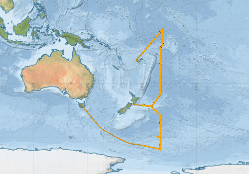
This record describes Hydrology (HYD) data collected from the Marine National Facility (MNF) RV Investigator voyage: in2016_v03, titled "Monitoring Ocean Change and Variability along 170 W from the ice edge to the equator." The voyage consisted of two legs: Leg-1 from Hobart (TAS) to Wellington (NZ) between April 27 and May 26 and Leg-2 from Wellington (NZ) to Lautoka (Fiji) from May 27 to June 28, 2016. Hydrology samples were collected from Niskin bottles sampled at various depths during a Conductivity-Temperature-Depth (CTD) deployment. Parameters analysed were salinity, dissolved oxygen, phosphate, silicate, nitrate plus nitrite and ammonium. Underway samples were also collected every 12 hours (or once every 24 if a CTD coincided with collection time) for nutrient analysis from the underway system which collects water from 7 m depth and is not filtered. This dataset has been archived at the CSIRO O&A Information and Data Centre (IDC) in Hobart. Additional information regarding this dataset is contained in the Voyage Report and Data Processing Report.
