Keyword
Earth Science | Oceans | Ocean Optics | Scattering
3 record(s)
Type of resources
Topics
Keywords
Contact for the resource
Provided by
Formats
Update frequencies
Status
draft
-
The Huon Estuary Study was undertaken by CSIRO Marine Research between 1996 and 1998. The Huon Estuary is in South Eastern Tasmania. This record references the CTD data from both the spatial (HES) and the weekly monitoring (CM) surveys of the Huon Estuary Study. For the spatial (HES) surveys this includes the raw, intermediate, processed and calibrated data. The record also references the software used to process this data together with the technical reports written in support of the datasets. Two ctd profilers were utilized during the spatial surveys, their deployment during the spatial surveys is described in a technical report CTD Data From the Spatial Surveys of the Huon Estuary, OMR-121/117. A technical report on the performance of the seabird ctd is Sea-Bird CTD Performance in a Salt-Wedge Estuary, OMR-116/117. For the weekly monitoring (CM) surveys only preliminary processing has been undertaken. A readme_cont_ctd.txt file describes the processing routine followed for the weekly monitoring surveys. This dataset has not been calibrated. There are also other problems with the weekly monitoring ctd data especially in terms of depth registration (see Lineage below). CTD deployment information (not the actual data) is stored in the project database which is described by the 'Huon Estuary Study 1996/1998 - Database' metadata record. A number of CTD's were also deployed during the Physical Snapshot Surveys (see Marlin record 'Huon Estuary Study 1996/1998 - Physical Snapshot Survey Data') These ctd's were quickly deployed, the data was not processed and they form part of the snapshot dataset along with underway data collected on the same day. For these reasons this data are not referenced by this metadata record and does not form part of the HES CTD dataset.
-

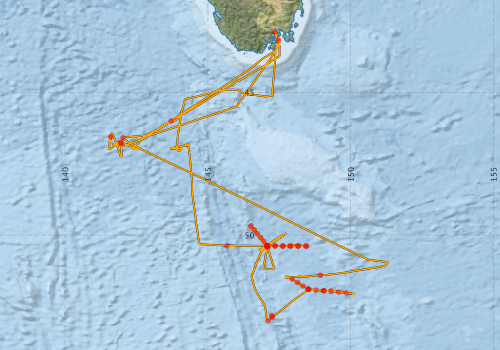
This record describes the Conductivity-Temperature-Depth (CTD) data collected from the Marine National Facility RV Investigator voyage IN2016_V02 Titled: "SOTS: Southern Ocean Time Series Automated Moorings for Climate and Carbon Cycle Studies Southwest of Tasmania". The voyage took place between the 13th March to 16th of April, 2016 departing Hobart (TAS) and returning to Hobart (TAS). Data for 40 deployments were acquired using the Seabird SBE911 CTD 20, fitted with 24 ten litre bottles on the rosette sampler. Sea-Bird-supplied and O&A Calibration Facility calibration factors were used to compute the pressures and preliminary conductivity values. CSIRO calibrations were applied to the temperature data. The data were subjected to automated QC to remove spikes and out-of-range values. The final conductivity calibration was based on a single deployment grouping. The final calibration from the secondary sensor had a standard deviation (S.D) of 0.00138 PSU, well within our target of ‘better than 0.002 PSU’. The standard product of 1dbar binned averaged were produced using data from the primary sensors. The dissolved oxygen data calibration from the secondary sensor was used for the final calibration. The fit had a S.D. of 0.792 uM. The agreement between the CTD and bottle data was good. The Biospherical photosynthetically active radiation (PAR), C-Star transmissometer and the Wetlabs ECO chlorophyll and scattering sensors were also installed on the auxiliary A/D channels of the CTD. The lowered ADCP was also attached to the package, logging internally during each cast. The collected data were subsequently processed and archived within the CSIRO Oceans and Atmosphere (O&A) Information and Data Centre (IDC) in Hobart. Additional information regarding this dataset may be contained in the Voyage Summary and the CTD Data Processing Report.
-
This record describes the CTD data collected on Investigator voyage IN2023_V07, titled: "SWOT-ACC: smaller scales of the Antarctic Circumpolar Current in a meander south of Tasmania." The voyage took place between November 15, 2023 and December 20, 2023 (AEST), departing from Hobart and returning to Hobart. The primary focus of this voyage was to enhance our ability to observe and comprehend the effects of small-scale motions (ranging from 10 to 100 km) on the dynamics of the Antarctic Circumpolar Current (ACC). The groundbreaking Surface Water Ocean Topography (SWOT) satellite mission will provide unprecedented measurements of sea surface height over a wide area with substantially improved spatial resolution compared to traditional altimeters. While SWOT will offer unparalleled coverage in both space and time, it is crucial to obtain in situ subsurface ocean measurements to validate the satellite observations and establish the connection between small-scale variability in sea surface height and subsurface ocean circulation and dynamics. Data for 111 CTD deployments were acquired using the Sea-Bird SBE9+V2 CTD unit #24 (S/N 1332), fitted with 36 twelve-litre bottles on the rosette sampler. Sea-Bird-supplied calibration factors were used to compute the pressures and preliminary conductivity values. CSIRO-supplied calibrations were applied to the temperature data. The data were subjected to automated QC to remove spikes and out-of-range values. The final conductivity calibration was based on a single deployment grouping. The final calibration from the primary sensor had a standard deviation (SD) of 0.0012454 PSU, within our target of ‘better than 0.002 PSU’. The standard product of 1-decibar binned averages were produced using data from the primary sensors. The dissolved oxygen data (primary) calibration fit had a SD of 0.78388 μM. The agreement between the CTD and bottle data was good. Additional sensors include: SUNA Nitrate, Altimeter (Tritech PA500), Transmissometer (Wetlabs CStar), CDOM, Chlorophyll-a, Scattering (Wetlabs ECO FLCDRTD) were installed on the auxiliary A/D channels of the CTD. The collected data were processed (quality-controlled), and subsequently archived by the CSIRO National Collections and Marine Infrastructure (NCMI) Information and Data Centre (IDC). Additional information regarding this dataset may be contained in the Voyage Summary and the Data Processing Report.
