Keyword
Earth Science | Oceans | Tides | Tidal Components
4 record(s)
Type of resources
Topics
Keywords
Contact for the resource
Provided by
Formats
Update frequencies
Status
draft
-

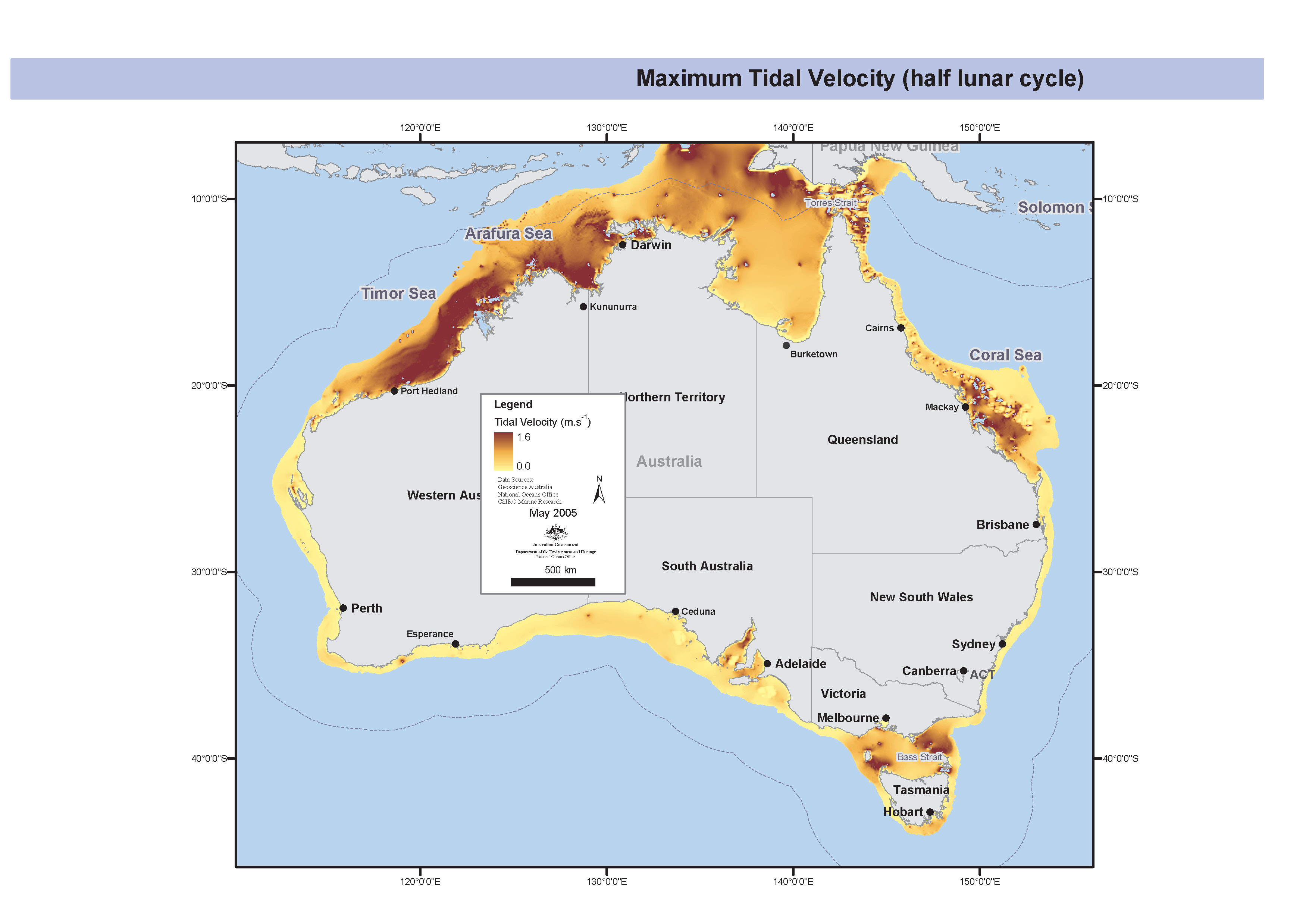
Map showing half lunar maximum tidal currents for the Australian Shelf. The tide data was generated from a tide model for the Australian Shelf which was set up for the region limited by 0 degrees S to 45 degrees S and 109 degrees E to 160 degrees E. The spatial and temporal resolution of the model output is 0.067 degrees in both latitude and longitude and half a lunar cycle respectively. The arc info gridded data was generated by Rick Smith and mapped by Donna Hayes.
-

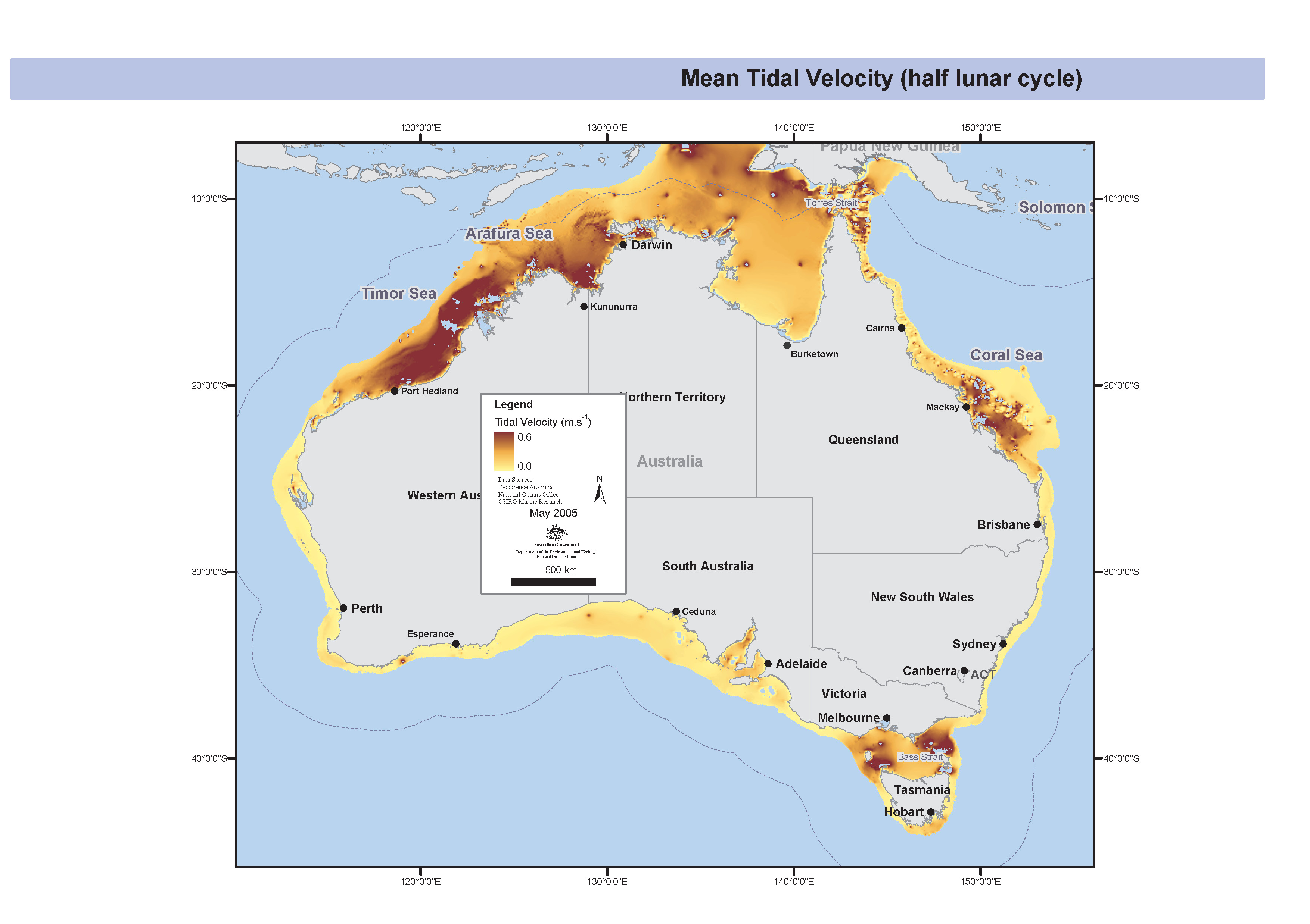
Map showing half lunar mean tidal currents for the Australian Shelf. The tide data was generated from a tide model for the Australian Shelf which was set up for the region limited by 0 degrees S to 45 degrees S and 109 degrees E to 160 degrees E. The spatial and temporal resolution of the model output is 0.067 degrees in both latitude and longitude and half a lunar cycle respectively. The arc info gridded data was generated by Rick Smith and mapped by Donna Hayes.
-
ESRI grids showing half lunar mean and maxium tidal currents for the Australian Shelf. The tide data was generated from a tide model for the Australian Shelf which was set up for the region limited by 0 degrees S to 45 degrees S and 109 degrees E to 160 degrees E. The spatial and temporal resolution of the model output is 0.067 degrees in both latitude and longitude and half a lunar cycle respectively. The arc info grided data was generated by Rick Smith and mapped by Donna Hayes.
-
The Northern Region Circulation (MECO) Model was developed as part of the FRDC Surrogates 1 project. It covers the region from Joseph Bonaparte Gulf to Torres Strait with a fixed horizontal resolution of 0.05 degrees. Outputs included sea level, currents, bottom stress, and other physical parameters. For this dataset the monthly mean non tidal currents for the Northern Marine Region were used to create GIS map layers. Currents are modeled and are not validated.
