Keyword
Earth Science | Biological Classification | Protists | Flagellates | Dinoflagellates
6 record(s)
Type of resources
Topics
Keywords
Contact for the resource
Provided by
Formats
Update frequencies
Status
draft
-

This dataset comprises the phytoplankton abundance and biovolume estimates as part of a broader sampling program carried out at the Southern Ocean Time Series, a facility within the Integrated Marine Observing System (IMOS). The primary focus is sustained observing of ocean properties and processes important to climate, carbon cycling, and ocean productivity. Regular phytoplankton samples are collected at approximately 14 day intervals (exact intervals and seasonal coverage dependent on deployment length). The moorings are serviced annually, at which time the existing moorings are recovered and new moorings are deployed. Water samples from within the surface mixed-layer are collected at pre-programmed intervals using a Remote Access Sampler, in pairs about 1 hour apart. One sample in each pair is preserved for phytoplankton community composition by microscopy, and the other sample is preserved and used for accompanying chemical analysis of nutrients, total dissolved inorganic carbon (DIC) and alkalinity. Each sample is collected from within the surface mixed-layer at 32 m depth (2010 - 2017) or 5 m depth (2018-current) depending on the design of the mooring surface assembly and instrumentation. Typically a maximum of 24 samples are collected over an annual deployment cycle. The samples collected are analysed for: 1. Community composition / abundance (cells/L) 2. calculated biovolume (um3/L). Protocols for the phytoplankton time-series are described in Eriksen et al (2018), and the annual sample reports for each deployment. Data storage and access is planned to be interoperable with other national and international programs through the IMOS Infrastructure. Station metadata can be found through this resource. Data is available freely via the AODN portal: https://portal.aodn.org.au. As the taxonomic resolution of the data has changed over time, due to continual training, it is important that users refer to the change log tables included in your data download. These will provide information on the validity of the taxa, from what date we have been identifying certain taxa etc. Classification fields may be blank depending on the level to which that taxa has been identified, i.e. if only identified to family, genus and species will be blank.
-

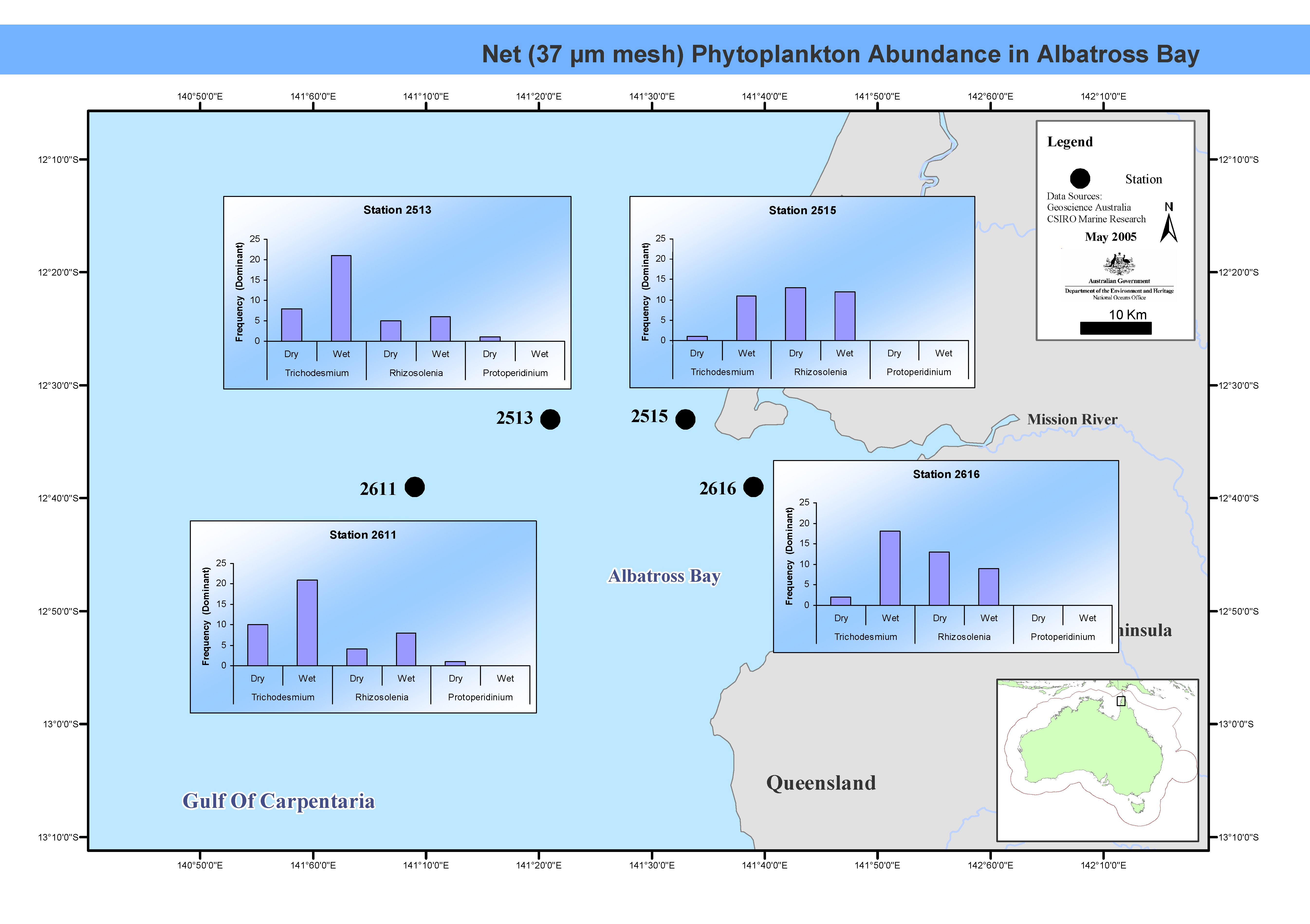
This map shows phytoplankton abundance in Albatross Bay. The biomass and species composition of tropical phytoplankton in Albatross Bay, Gulf of Carpentaria, northern Australia, were examined monthly for six years between March 1986 and April 1992. Phytoplankton taxonomic groups were identified to genus level, and described as dominant, common or rare. This map has been produced by CSIRO for the National Oceans Office, as part of an ongoing commitment to natural resource planning and management through the 'National Marine Bioregionalisation' project.
-
The Huon Estuary Study was undertaken by CSIRO Marine Research between 1996 and 1998. The Huon Estuary is in South Eastern Tasmania. This record references the optical absorption data from both the spatial (HES) and the weekly monitoring (CM) surveys of the Huon Estuary Study. This dataset includes phytoplankton, spectral absorption and HPLC pigments. Final data for the pigment and phytoplankton data has been stored within the HES database which has been refered to by metadata record 'Huon Estuary Study 1996/1998 - Database'. The final datasets have also been written to cdrom as text files for archiving purposes by the Data Centre, Hobart. The spectral absortion data is scheduled to be reworked and will be added to the archive when it becomes available.
-

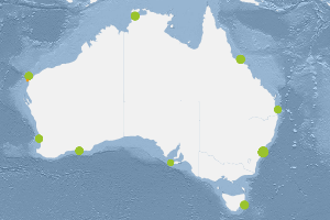
This dataset comprises the phytoplankton abundance and biovolume estimates of a broader sampling program carried out by the Plankton National Reference Station within the Integrated Marine Observing system. Regular monthly phytoplankton samples are undertaken at the stations as part of a larger water sampling program by the Australian National Reference Stations. In total nine stations are sampled regularly around the Australian coastline. Sampling is conducted monthly (Esperance and Ningaloo 3 monthly) off small vessels at each of the nine reference stations. The sampling is an integrated water sample collected with niskin bottles at 10m depth intervals and preserved in lugols solution. The depth of the sample varies at each station. The plankton ecology lab (based in Queensland) will analyse the samples collected for: 1. Community composition / abundance (cells/l) 2. Biovolume (um3/L). Data storage and access is planned to be interoperable with other national and international programs through the IMOS Infrastructure. Station metadata can be found through this resource. Data is available freely via the AODN portal: https://portal.aodn.org.au. As the taxonomic resolution of the data has changed over time, due to continual training, it is important that users refer to the change log tables included in your data download. These will provide information on the validity of the taxa, from what date we have been identifying certain taxa etc. Classification fields may be blank depending on the level to which that taxa has been identified, i.e. if only identified to family, genus and species will be blank.
-
This record references the database of the final data from the Huon Estuary Study. The data from the project's access database has been transfered into an oracle database which is available on-line to project members. The access database tables have also been exported to text files for archiving to cdrom (held in CMR Data Centre-May 2004.) Data Dictionary files have also been stored on cdrom along with technical reports which describe the data modelling undertaken for the project. The database contains ammonia, arsenic, ctd header, dissolved oxygen, mercury, nutrient, organic matter, pigment, salinity, sediment, suspended solids, taxon counts and dominance data in their final processed form. Data in the database was collected at 61 stations on a seasonal regime (HES Surveys) Weekly/fortnightly (CM Surveys)at 5 of those stations. A sediment survey in May 1997 (SED1) and a Contaminants Survey in August/September 1998 (HES10A) were also carried out. The study was undertaken over the period 1996-1998. Refer to the other Huon Estuary Study metadata records to explore datasets which were not loaded into the database such as the ctd, snapshot and moored instrument data.
-
The Interim Register of Marine and Nonmarine Genera (IRMNG) is a provisional (or ‘interim’) compilation of genus names – including species names in many cases – and covers both living and extinct biota into a single system to support taxonomic and other queries dealing with e.g. homonyms, authorities, parent-child relationships, spelling variations and distinctions between marine and non-marine or fossil and recent taxa. Taxonomic names in IRMNG are assigned flags to distinguish between marine vs. non-marine, and extant vs. fossil status; they are also arranged into a simple management hierarchy for navigation purposes, compilation of statistics per taxonomic group and more. Fuzzy matching is also supported (using "Taxamatch") so that a misspelled name can in most instances be reconciled to a correctly spelled name at genus or species rank, where this is held. IRMNG was a project of OBIS Australia designed to assist in the provision of marine species data to OBIS, by permitting the discrimination of marine from nonmarine (and extant from fossil) species records on the basis of the genus name portion of their scientific name (normally, genus + species, or genus + species + infraspecies if applicable). The aim of the project is to (a) assemble as complete a list as possible of the estimated 150,000 extant and 50,000 fossil generic names in current use, plus their possible further 250,000-300,000 synonyms, and (b) flag as many of these as is possible with their marine/nonmarine, and extant/fossil, status. Relevant species lists are also being attached to the "correct" instances of genus names as available. IRMNG was developed and based at CSIRO, Australia from 2006-2014, and from 2016 onwards it is now hosted at VLIZ, Belgium: http://www.irmng.org/
