Mapset: Currents in the Northern Marine Region
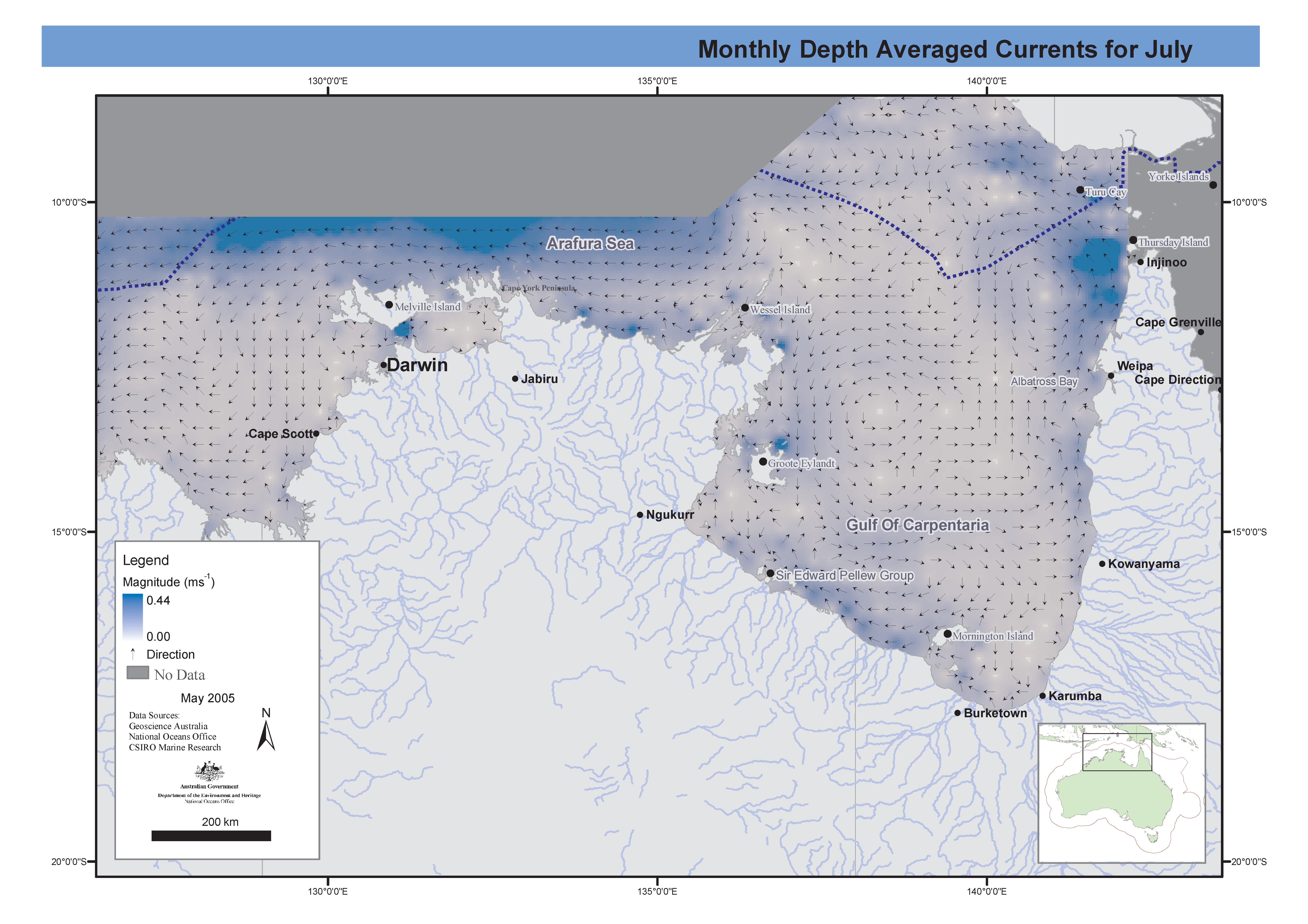
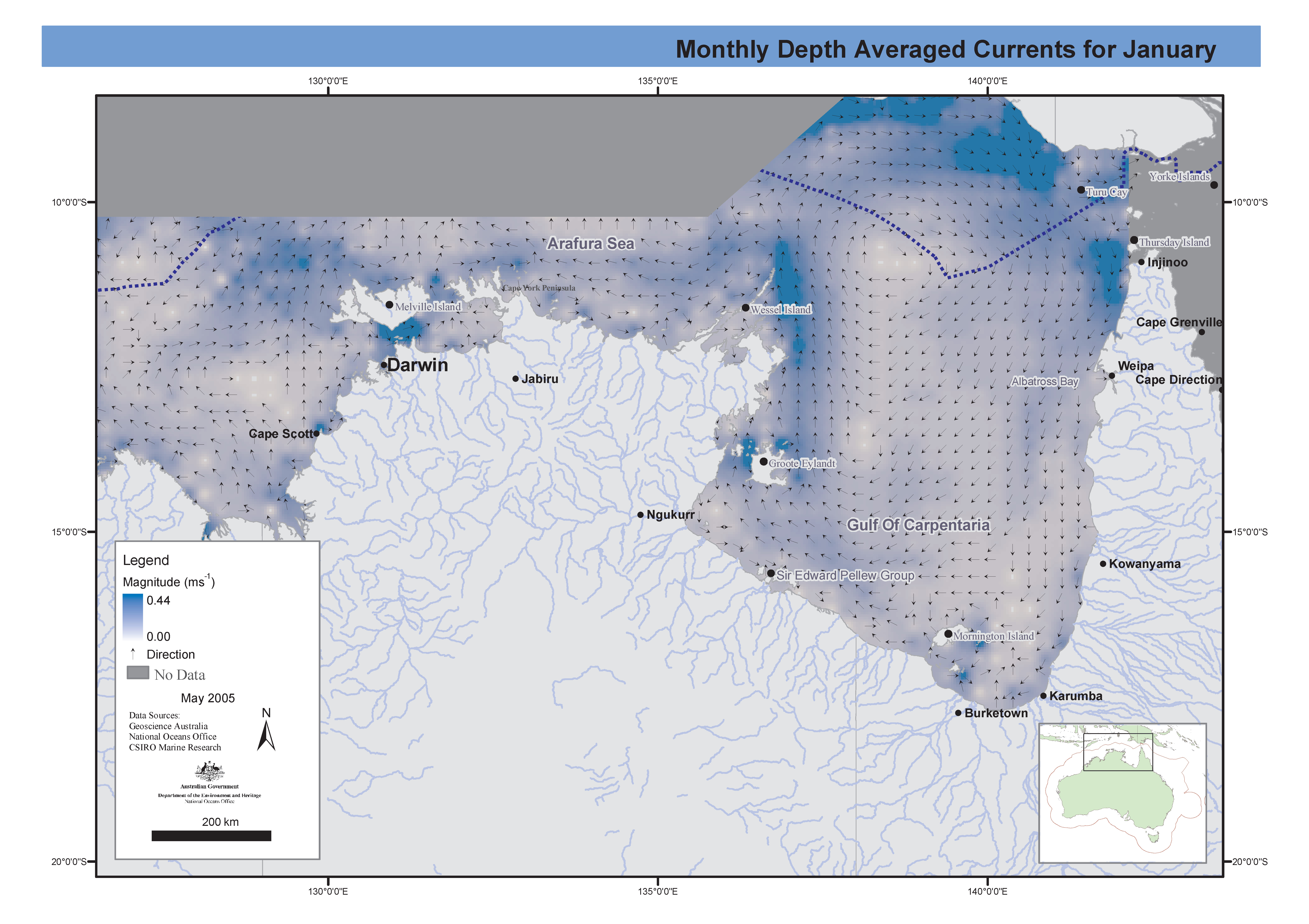
Set of maps showing currents in the Northern Marine Region for the wet (January) and dry (July) seasons. These maps have been produced by CSIRO for the National Oceans Office, as part of an ongoing commitment to natural resource planning and management through the 'National Marine Bioregionalisation' project.
Simple
Identification info
- Date
- Citation identifier
- Marlin Record Number: 8143
- Citation identifier
- Anzlic Identifier: ANZCW1205000875
- Status
- Completed
- Point of contact
-
Role Organisation Electronic mail address Point of contact CSIRO Oceans & Atmosphere - Hobart
- Topic category
-
- Oceans
Extent
))
Temporal extent
- Time period
- 2004-09 2004-12
- Maintenance and update frequency
- Not planned
- GCMD Keywords
- AODN Geographic Extent Names
Resource constraints
- Other constraints
-
No Restrictions
- Language
- English
- Character encoding
- UTF8
- Supplemental Information
-
ATTRIBUTE STATEMENT:
Contains ESRI layers relating to the map title, AUSLIG standard coastline, Jurisdictional boundaries, town and city locations, rivers
Distribution Information
- Distribution format
-
-
DIGITAL - Images - JPEG
-
DIGITAL - Images - PDF
-
- OnLine resource
-
Graphics Link
current_jul.pdf (920 KB)
- OnLine resource
-
Graphics Link
current_jan.pdf (909 KB)
Data quality info
- Hierarchy level
- Dataset
Report
Result
- Date (Publication)
- Explanation
-
N/A
Report
Result
- Date (Publication)
- Explanation
-
Complete
Resource lineage
- Statement
-
The map layers and design layout were assembled using ESRI ArcGIS products by Donna Hayes at CSIRO. Grids used for mapping were spline interpolated from the 1/2 degree grids.
- Hierarchy level
- Dataset
Reference System Information
- Reference system identifier
- Other - Please comment
Metadata
- Metadata identifier
- 623f2ad4-3618-4456-a861-f18cf73bcb43
- Language
- English
- Character encoding
- UTF8
- Contact
-
Role Organisation Electronic mail address Point of contact CSIRO Oceans & Atmosphere - Hobart
- Metadata linkage
-
Point of truth URL of this metadata record
Point of truth URL of this metadata record
- Date info (Creation)
- 2008-07-01T00:00:00
- Date info (Revision)
- 2008-07-01T10:14:21
Metadata standard
- Title
-
ISO 19115-3:2018
- Title
-
Marine Community Profile
- Date (Creation)
- 2019-05-30
- Edition
-
3.0
- Edition date
- 2019-05-30T00:00:00
- Cited responsible party
-
Role Organisation Electronic mail address Custodian Marine Community Profile Governance Committee
Overviews
Spatial extent
)))
Provided by
